Observed Movements | Joints | Columnar Jointing | Faults | Normal Faults | Thrust Faults | Lewis Overthrust, Glacier Natl. Park | Earthquakes, General | Seismographs and Records | Earthquake Regions, General | Japan | California – Nevada | History of Earthquake Science | Rock Folding | Folded Rocks | Monoclinal Rocks | Hog Back Ridges
OBSERVED MOVEMENTS |
|
| 431.-.1 | Columns bored by marine mollusks, from 12 feet to 20 feet. Temple of Jupiter Serapis, Pozzuoli, near Naples, Italy. |
| 431.-.2 | Cliffs showing post-glacial erosion bench, now uplifted. Near Loblolly Cave, Cape Ann, Massachusetts. |
| 431.-.3 | Wave-cut terraces, south west coast of San Clemente Island, California. 18th Annual, part 3. |
| 431.-.4 | Terraces above Seal Harbor, San Clemente Island, California. 18th Annual, part 3. |
| 431.-.5 | Elevated wave-cut rock bench. Seward Penninsula, Alaska. |
JOINTS |
|
| 437.-.1 | Joint planes. Cayuga lake cliffs. Ithaca, New York. |
| 437.-.2 | Joints in Portage flagstones quarry south of Watkins, New York. |
| 437.-.3 | Joints in massive limestone. Lion of Lucerne. |
| 437.-.4 | Joints. Middle Quarry Slate Co., Middle Granville, Washington County, N.Y. |
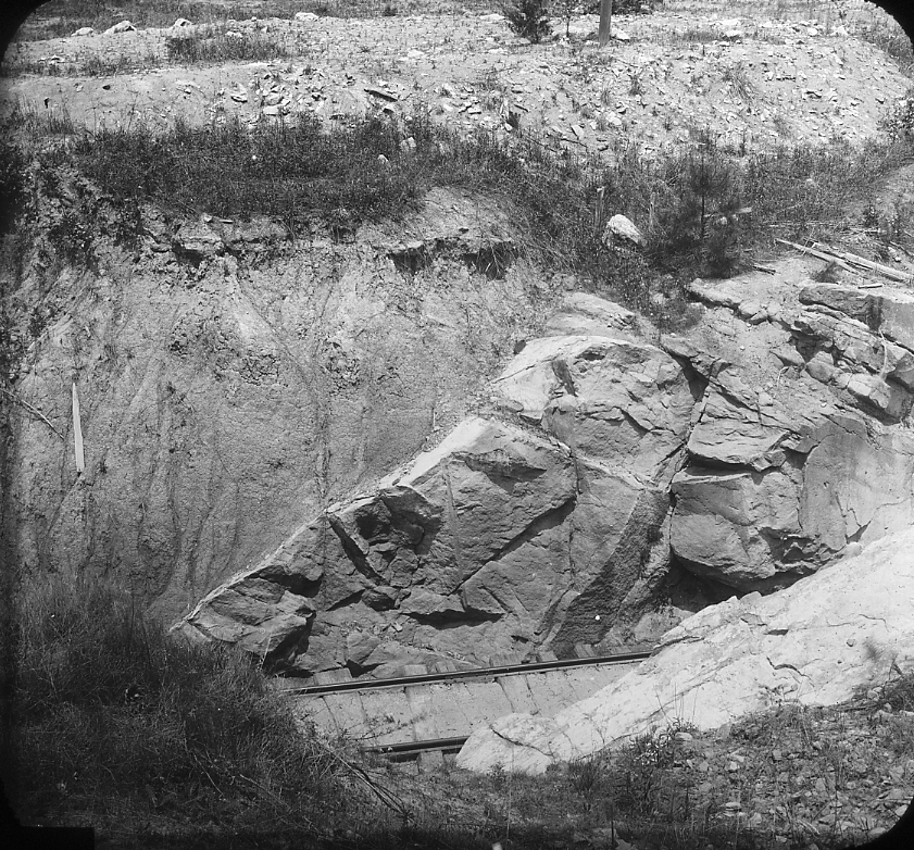
| 437.-.5 | Jointing in granite; Canyon of Tongue River, southeast of Dayton, Wyo. |
| 437.-.6 | Weathering in granite. Black River, Missouri. |
| 437.-.7 | Devil’s Oven, Au Sable Chasm, New York. |
| 437.-.8 | Washington Column, Yosemite Park, California. |
| 437.-.9 | Joints in bed of Rocky River, Chagrin Shale, Cleveland, Ohio. |
| 437.-.10 | Joints in Cleveland Shale. River silts and glacial boulders. Black River, above Lorain, Ohio. |
| 437.-.11 | Joints in Cleveland Shale. River silts and glacial boulders. Same locality as 437.-.10 to show pattern. Black River, above Lorian, Ohio. |
| 437.-.12 | Weathering of Ohio Shale, hard, black, brittle, under joint control. North of Columbus, Ohio. |
COLUMNAR JOINTING |
|
| 439.-.1 | Obsidian columns, Obsidian Cliff, Yellowstone Park, Wyom. |
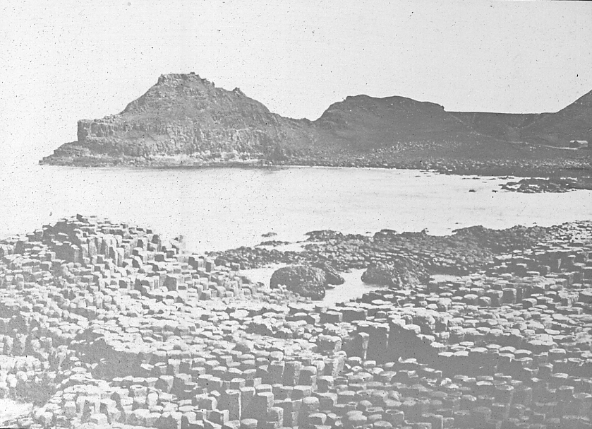
| 439.-.2 | Shrinkage of joints, basaly columns, Giant’s Causeway, Ire. |
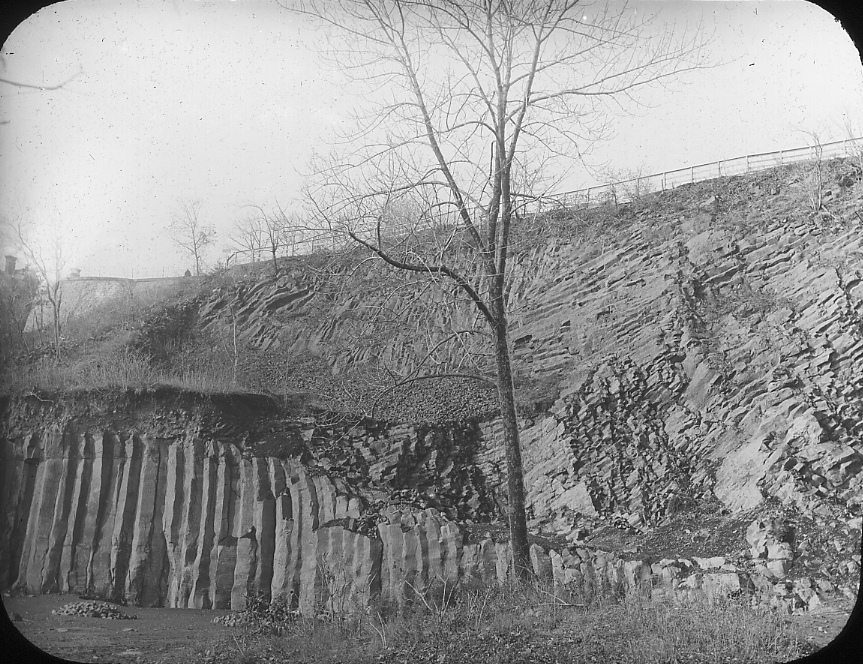
| 439.-.3 | Intrusive diabase showing columns: Triassic Trap, Orange quarry, N.J. |
| 439.-.4 | Columnar andesite of Kasbek, near village of Kasbek. By E. O. Hovey. 16. IX. 97. |
| 439.-.5 | Polygonal masonry of basalt. 1 mile south from Clermont Ferrand, Auvergne. |
FAULTS |
|
NORMAL FAULTS |
|
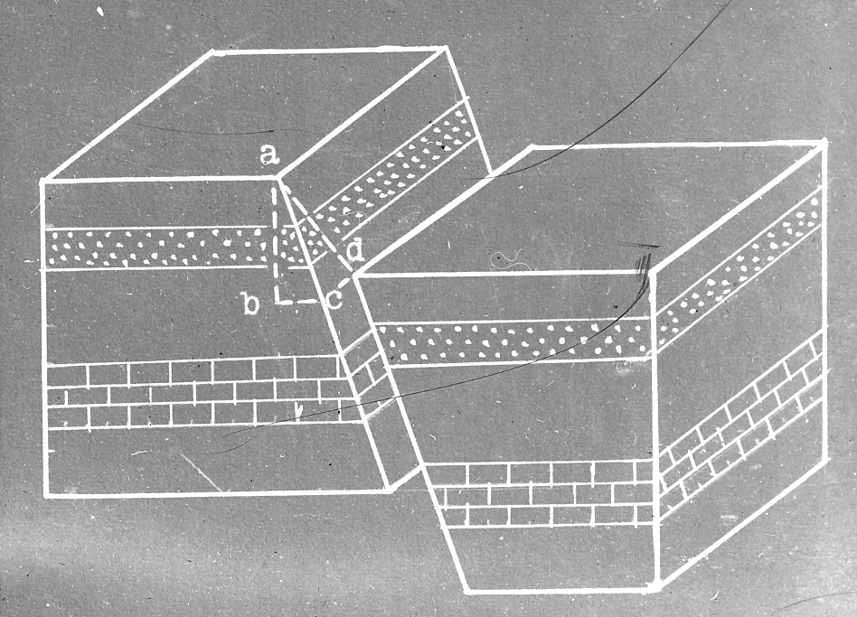
| 441.-.1 | Diagram of faults to show throw, heave and shift. |
| 441.-.2 | Small faults in shaley sandstone, Newark Series; South Meridan, Conn. 18th Annual, part 3. |
| 441.-.3 | Fault in the sandstone and shale of the Newark system, near Wadsborough, North Carolina. |
| 441.-.4 | fault scarp and depressed block to east; head of Dogwood Creek, Plumas County, California. |
| 441.-.5 | Fault climbs cliff diagonally from right to left. Calciferous in cliff, updragged Utica at left. Dolgeville Fault, East Canada Creek, New York. |
| 441.-.6 | Updrag in Utica shale on downthrow side of Dolgeville Fault. East canada Creek, New York. |
| 441.-.7 | The Irvine-Paintsville Fault. 80 miles long; 150 foot displacement. Maxville limestone on right, Waverly on left. Wolfe County, Ky. See 441.-.14. |
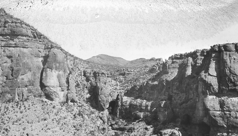
| 441.-.8 | Chalk Draw Fault on right, central block downthroen 1000 feet. On left the sharpl folded and overthrust Santiago (Rocky Mtn.) Range. 35 miles southeast of Alpine, Brewster County, Texas. |
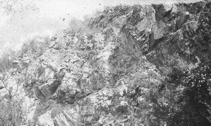
| 441.-.9 | Secondary fault just west of and parallel to Chalk Draw Fault; displacement about 50 feet. 35 miles southeast of Alpine, Brewster County, Texas. |
| 441.-.10 | Center of 9 point Mesa Fault. In center of view between sedimentary butte and igneous rocks of mesa on left. Down throw on left, 800 feet. 40 miles south of Alpine, Brewster County, Tex. looking northwest. |
| 441.-.11 | 9 point Mesa Fault, zone of displacement. Downthrown trap on right, limestone on left. View to southeast. 40 miles south Alpine, Brewster County, Texas. |
| 441.-.12 | Northwest end of 9 Point Mesa Fault, looking northwest (12 miles long) downthrow on left of median escarpment. 35 miles south Alpine, Brewster County, Texas. |
| 441.-.13 | Southeast end of 9 Point Mesa Fault, view southeast, Limestones on right downthrown 300 feet and against basalt. 45 miles south Alpine, Brewster County, Texas. |
| 441.-.14 | Fault plane and drag of one of Kentucky River Faults. Downthrow on left. Opening made for possible mine for berite, lead and zinc. Lancaster, Ky. See 441.-.7 |
THRUST FAULTS |
|
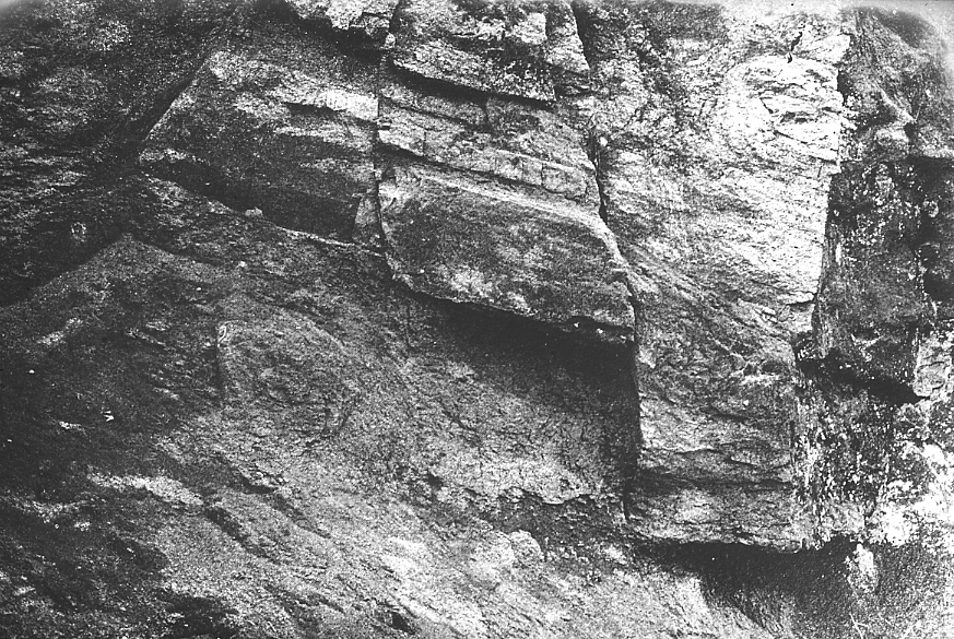
| 443.-.1 | Plane of overthrust fault. Highgate Falls, Vermont. |
| 443.-.2 | Flat fault. Lower beds underthrust, and other beds compressed so that effect dies out at west end of section. Castlemaine, Victoria. |
LEWIS OVERTHRUST, GLACIER NATL. PARK. |
|
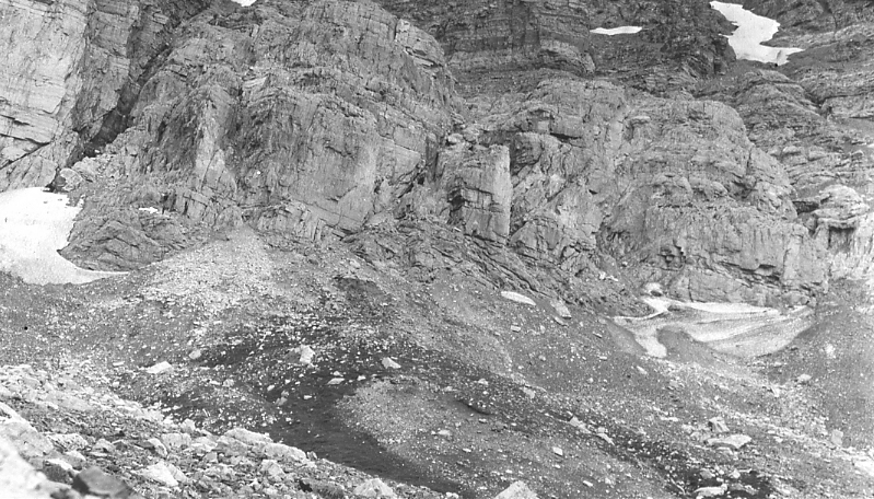
| 443.B.1 | Lewis Thrust, S. wall Swift Current Valley, base of Point Mt. |
| 443.B.2 | Lewis Thrust, S. wall Swift Current Valley, eastward from top of Mt. Altyn. |
| 443.B.3 | Lewis Thrust zone, N. Wall Swift Current Valley. |
| 443.B.4 | Lewis Thrust zone, below base of cliff, along N. wall of Swift Current Valley. |
| 443.B.5 | Lewis and Livingston Ranges of Belt Pre-Cambrian overthrust onto Cretaceous of Great Plains. Map. |
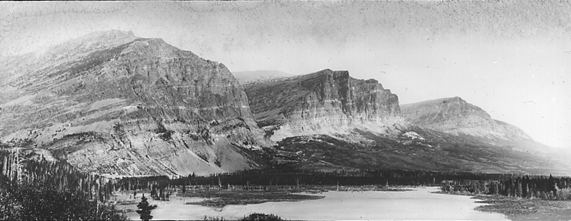
| 443.B.6 | Overthrust fault of front range in northern Montana, with view of Chief Mountain. |
EARTHQUAKES |
|
GENERAL |
|
| 449.-.1 | Earthquake belts of the earth. |
| 449.-.2 | Population Density of the Earth. |
SEISMOGRAPHS AND RECORDS |
|
| 453.-.1 | Seismograph. One component of Omori Horizontal Pendulum. |
| 453.-.2 | Seismograph record of Alaskan Earthquake of Sept. 11, 1899. Tokyo. |
| 453.-.3 | Part of record of pulsatory Oscillation Storm of November 17-18, 1900. Japan (Tokyo). 46 such storms in Tokyo in 1900. If ther are not felt, local earthquakes schocks are felt and these have been predicted to 10 or 12 hours. |
| 453.-.4 | Curve of frequency of aftershocks of Mino-Owari Earthquake, Japan. |
EARTHQUAKE REGIONS |
|
GENERAL |
|
| 457.-.1 | Crevasse near Guevejar, opened by earthquake in Spain. |
JAPAN |
|
| 457.B.1 | Distribution of destructive earthquakes in Japan and Tsunamis since the 5th Century. (Color scheme of first must be used carefully). |
| 457.B.2 | Vertical displacement, maximum 20 ft., on fault which caused the Mino-Owari earthquake of October 28th, 1891. Japan. |
| 457.B.3 | Japanese building, result of centuries of trial and error. Nagoya Castle, immediately following the Mino-Owari earthquake, 1891. |
| 457.B.4 | American type of imll structure which failed because of mal-adaption to earthquake conditions. Nagoya spinning mill, Mino-Owari earthquake, 1891. |
| 457.B.5 | Model of farmer’s cottage designed to withstand earthquakes. Designed and distributed by the Jap. Imp. Earthquake Commission. |
| 457.B.6 | Model of dewlling house designed and distributed by the Jap. Imp. Earthquake Comission. |
| 457.B.7 | Framework, Japan Oil Building, showing heavy frame sway-bracing and heavily enforced columns to withstand earthquakes. Novenmber 15, 1921. |
| 457.B.8 | N.Y.K. or Yusen Building, March 1, 1922. Heavy steel framework with sway bracing and reinforced column. Tokyo, Japan. |
| 457.B.9 | Japan Oil Building, as completed August 1, 1922. Tokyo, Japan. |
| 457.B.10 | Japan Oil Building, September 28, 1923, after earthquake of September 2, 1923. Damaged by shearing of terra cotta facing of lower floors. Tokyo, Japan. |
| 457.B.11 | Japan Oil Building, September 28, 1923, after earthquake of September 2, 1923. Damaged by shearing of terra cotta facing. Shows forward-and-back motion of lower floors. Tokyo, Japan. |
| 457.B.12 | N.Y.K. or Yusen Building, completed October 15, 1922. Yokyo, Japan. |
| 457.B.13 | N.Y.K. or Yusen Building, September 28, 1923. Damaged by earthquake of September 2, 1923. Note shearing of tile facing on first floor, result of motion in lower floors. Tokyo, Japan. |
| 467.B.14 | N.Y.K. or Yusen Building, September 28, 1923. Damaged by earthquake of September 2, 1923. Tokyo, Japan. |
| 467.B.15 | Marunouchi Building, May 1, 1922. Damaged by earthquake of 1922. Brick of second and third floors sheared off showing nature of movement. Tokyo, Japan. |
| 457.B.16 | Marunouchi Building, September 28, 1923. Damaged by earthquake of September 2, 1923. Shearing off brick facing on second and third and fourth floors. Tokyo, Japan. |
CALIFORNIA – NEVADA |
|
| 457.C.1 | Fault map of California and Nevada. |
| 457.C.2 | Earthquakes in California in 1917. Number in circle indicates number of ‘quakes recorded. |
| 457.C.3 | Isoseismal map of California earthquake of April 18, 1906. |
| 457.C.4 | Buckling caused by earth flow. Howard St., San Francisco, California. |
| 457.C.5 | Cracks in wall of vault, San Francisco Earthquake. |
| 457.C.6 | Geological profiles with corresponding intensity curves through the city of San Francisco. |
| 457.C.7 | The northern most segment of the San Andreas Rift, Wood Gulch, Humboldt County, California, 190 miles northwest of San Francisco. |
| 457.C.8 | San Andreas Fault with vertical displacement of April 18, 1906. Wood Gulch, Humboldt Co., 190 miles northwest of San Francisco, Cal. |
| 457.C.9 | San Andreas fault line. Displacement of 13 feet, of April 18, 1906. Near Pt. Arena, Cal., 110 miles northwest of San Francisco, Cal. |
| 457.C.10 | San Andreas Rift and trace of the April 18, 1906 displacement. Fort Ross, 40 miles southeast of Pt. Arena, Cal., 70 miles northwest of San Francisco. |
| 457.C.11 | San Andreas Rift. Near Pt. Reyes, 30 miles northwest of San Francisco. |
| 457.C.12 | San Andreas Fault trace passes between steps and path on left. Displacement April 18, 1906, 15 feet, 9 inches. Near Pt. Reyes, Cal., 30 miles northwest of San Francisco. |
| 457.C.13 | San Andreas Rift. Fault trace near Pt. Reyes, 30 miles northwest of San Francisco, Cal. |
| 457.C.14 | San Francisco earthquake; fence parted along San Andreas Fault. |
| 457.C.15 | San Andreas Rift. Displacement of April 18, 1906, 20 feet. Near Pt. Reyes, 30 miles northwest of San Francisco, Cal. |
| 457.C.16 | San Andreas fault trace, near Pt. Reyes, 30 miles northwest of San Francisco, Cal. |
| 457.C.17 | San Andreas Fault, displacement of 6 feet of April 18, 1906. 15 miles south of San Francisco, south of San Andreas Lake. |
| 457.C.18 | San Andreas Rift. San Benito, San Benito Co., Cal. 120 miles southeast of San Francisco. |
| 457.C.19 | House on San Andreas fault line torn asunder by earthquake. California. |
| 457.C.20 | California Earthquake of April 18, 1906. Explanation of movement as two blocks which slipped past each other at that moment. |
| 457.C.21 | California Earthquake, April 1906. Triangulation network around San Francisco Bay. |
| 457.C.22 | California Earthquake, April 18, 1906. Character of displacement along San Andreas fault, shown by retriangulation. Arrows show direction and amount of movement, but on a much greater scale than the rest of the map. |
| 457.C.23 | California Earthquake, April 18, 1906. Interpretations of character of movement on San Andreas Fault. |
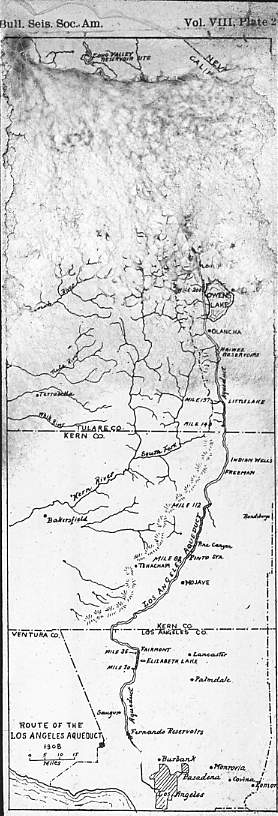
| 457.C.24 | Route of Los Angeles aqueduct. Between miles 30 and 36, it crosses in a tunnel the San Andreas fault. The Earthquake of 1857 was caused by displacement along this part of the fault. The water supply of the city is imperiled by future movements in the same region. It is also imperiled by shocks in the Owens Valley where the Alabama Hills are an active fault scarp. |
| 457.C.25 | Pleasant Valley, Nevada, Earthquake of October 2, 1915. Earthquake rift along base of Sonoma Range. Total length 18 miles, displacement vertical, 10-15 feet. Fault face slickensided. |
| 457.C.26 | Isoseismals of important California-Nevada earthquakes. 1910-1918. |
| 457.C.27 | Shifts in position of triangulation points in California between 1906-7, and 1922-23. |
| 457.C.28 | San Andreas Fault in Southern California, possibly offset by a cross fault. From airplane. Exact location and altitude unknown. |
HISTORY OF EARTHQUAKE SCIENCE |
|
| 463.-.1 | Count Omori. |
ROCK FOLDING |
|
FOLDED ROCKS |
|
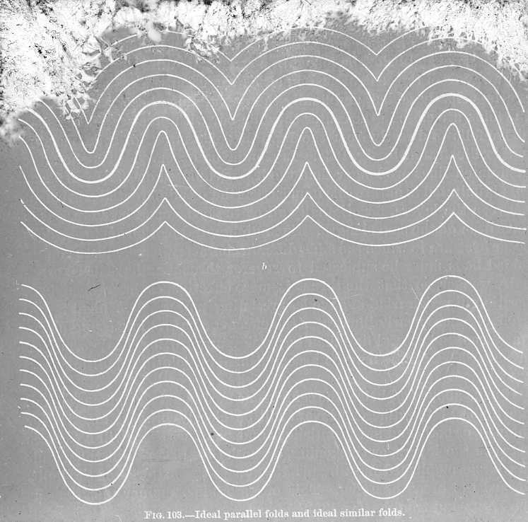
| 471.-.1 | Diagram of ideal parallel folds and similar folds, after Van Hise. |
| 471.-.2 | Diagram of bent rock stratum showing stretching on upper, and compression on lower portion. |
| 471.-.3 | Anticlinal fold, Chesapeake and Ohio Canal, near Hancock, West Va. |
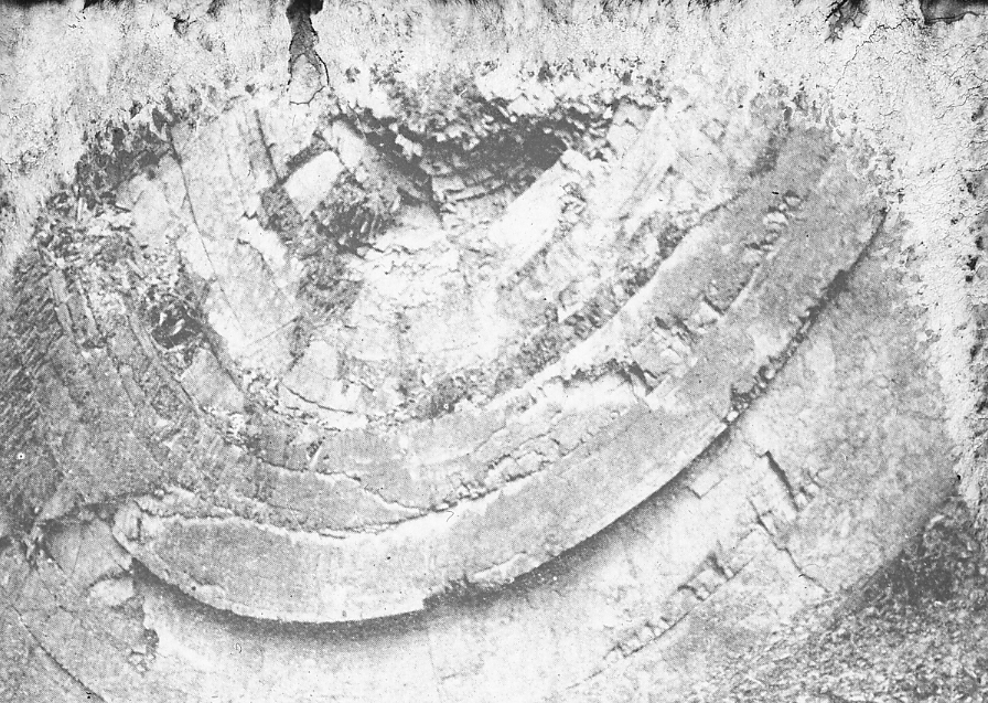
| 471.-.4 | Anticlinal fold; pitch forward, radial jointing. Castlemaine, Victoria. |
| 471.-.5 | Syncline; Chesapeake and Ohio Canal, 3 miles west of Hancock, Maryland. |
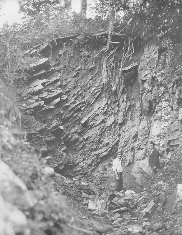
| 471.-.6 | Syncline in Martinsburg Shale, 3 miles northeast of Upton, Penna. |
| 471.-.7 | Synclinal fold; outcrop of massive sandstone 12 feet thick, Castlemaine Victoria. |
| 471.-.8 | Anticline by road near Levis Railroad station, Quebec, Canada. |
| 471.-.9 | Recumbant folds, in Cambrian, Doe River, Tenessee. |
| 471.-.10 | Overturned fold. South Axenstrasse, Lucerne. |
| 471.-.11 | Overturned folds, 3 miles north of Fluelen, Axenstrasse, Lake Lucerne. |
| 471.-.12 | Fold, Front Range of Big Horn Mountains, Wyoming. |
| 471.-.13 | Section across folded Appalachians. Rockbridge and Bath Counties, Va. |
| 471.-.14 | Carboniferous anticline, Joggins Coast, Nova Scotia. |
| 471.-.15 | Postglacial buckle in Loweville, 3 miles north of Watertown, N.Y. |
| 471.-.16 | Postglacial buckle in Loweville, 3 miles north of Watertown, N.Y. Same as preceding, looking other way. |
| 471.-.17 | Postglacial buckle in Potsdam sandstone, 2 miles south of Chippewa Bay, St. Lawrence County, New York. |
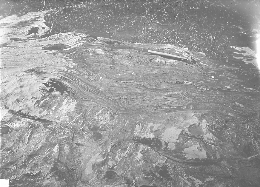
| 471.-.18 | Folded slates in Quebec group at Riviere de Loup, Quebec. |
| 471.-.19 | Contorted slate over massive limestone. |
| 471.-.20 | Plicated thinly bedded chert and limestone. Big Pine, Inyo Co., Cal. |
| 471.-.21 | Eroded anticline. Aerial photo-map of N.W. end of North Dome, Kettleman Hills, Kings and Fresno Counties, California. Section lines, N-S, E-W, give the scale. One of the greatest, N.A. oil fields, procuring pure gasoline. |
MONOCLINAL ROCKS |
|
| 473.-.1 | Triassic sandstones, showing dip and strike; Connecticut River Smith’s Ferry, Massachusetts. |
| 473.-.2 | Tilted rocks, Woods Bay, Bristol Channel, Devonshire, England. |
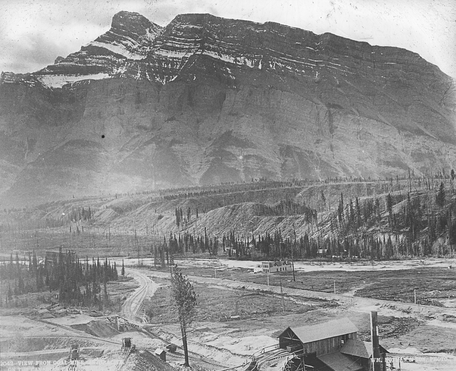
| 473.-.3 | Tilted rocks from coal mine on Canadian Pacific Railway. |
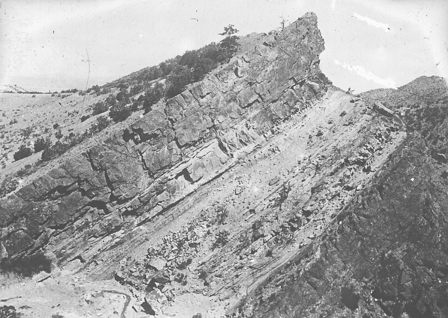
| 473.-.4 | Devils Slide, Utah. U.P.R.R. east of Salt Lake City. Beds of Jurassic Limestone interbedded with soft shales, 20 feet thick. The limestones stand 40 feet above slope of canyon wall. |
HOG BACK RIDGES |
|
| 475.-.1 | Tilted Jurassic Rocks, Wyoming. |
| 475.-.2 | Monoclinal ridge, Colorado City, Colorado. |
| 475.-.3 | Monoclinal structure, hogback ridges, near Gallup, western New Mexico. Entire section above the McElmo shown 1730′ thickness of rocks. See filing card for details. |
| 481.-.1 | Diagram of unconformity and subsequent wear. |
| 481.-.2 | Unconformity of Red Beds on Millsap limestone, Canyon, Colorado. |
| 481.-.3 | Unconformable contact, gneiss and Trenton, 1/2 mile from Montmorency Falls, New York. |
| 481.-.4 | Unconformity of Deadwood sandstone on Algonkian schists, Deadwood, S.D. |
| 481.-.5 | Unconformity, Black Reef on Ventersdorp Series. Rietfontein, Transvaal. |
| 481.-.6 | Unconformity, Wahsatch conglomerate on Laramie sandstone, Dry Cottonwood Creek, Wyoming. |
| 481.B.1 | Mid-ordovician limestone overlapping unconformably on Pre-cambrian granite. 4 miles N.E. Kingston, Ontario. |
| 481.B.2 | Mid-ordovician limestone overlapping unconformably on Pre-cambrian granite. Detail of 481.B.1. Boulders of granite embedded in limestone. 4 miles N.E. Kingston, Ontario. |
| 481.B.3 | Mid-ordovician limestone overlapping unconformably on Pre-cambrian granite. N.E.–S.W. joints in granite opened by Pre-ordovician weathering. 1 mile E. Kingston, Ontario. See slide 401.B.3 for setting of this slide. |
| 481.B.4 | Mid-ordovician limestone overlapping unconformably on Pre-cambrian granite. Boulders of granite and smaller pebbles embedded in basal bed of limestone subsequently glaciated. 1 mile E. Kingston, Ont. |
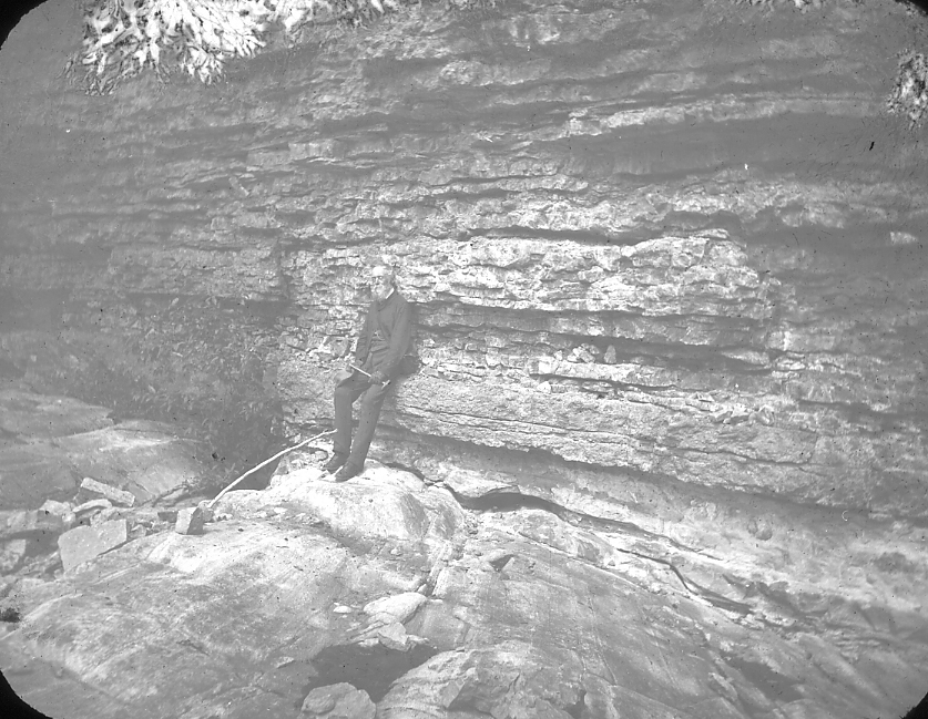
| 481.B.5 | Pottsdam sandstone (upper Cambrian) overlapping unconformably on Pre-Cambrian gneiss. Contact at man’s feet. 15 mi. N.E. Kingston, Ont. Slide 401.A.3 shows setting of locality of slides 481.B.3 and 4. They are at water level on right side of bay below dead tree. |