Swiss Alps | Alaska | Western United States | Glacier National Park | Piedmont | Continental | Load, Glacial Moraines | Load, Glacial-Fluviatile | Erosion | Effects of Alpine Glaciers | Alpine Glacier Topography | Swiss Alps | Big Horn Mountains | Yosemite, Sierra Nevada | Alaska and British Columbia | Norway Fiord | Effects of Continental Glaciers | Striae | Kelley’s Island | Till | Moraines | Jackson, Michigan | Chillicothe, Ohio | Burton, Geauga County, Ohio | Till Plains | Drumlins | Gravels and Sands | Kames | Eskers | Outwash Plains | Terraces | Drainage Changes | Icebergs | Lake and Sea Ice
SWISS ALPS |
|
| 137.B.1 | Viesch Glacier; Valais Alps. |
| 137.B.2 | Matterhorn and Dent d’Herens, looking S.S.W, across the Znutt glacier. Matterhorn glacier hanging on left. |
| 137.B.3 | Nevee region with bergschrund, Wasenhorn, Eggeshorn, Alps. |
| 137.B.4 | Lower end of the Forno (Alpine) Glacier, Switzerland. |
| 137.B.5 | Looking across valley of Chamounix, Mont Blanc, Alps of Savoy. |
| 137.B.6 | Glacier du Bois and valley of Chamounix, Switzerland. |
| 137.B.7 | Glacier des Bossoms, Switzerland. |
| 137.B.8 | Crevassed ice of Needles of Glacier des Bossoms, Switzerland. |
| 137.B.9 | Boulder on ice pinnacle, Forno Glacier, Switzerland. |
| 137.B.10 | The Marjelen See and Aletsch Glacier; Bernese Oberland. |
| 137.B.11 | Matterhorn, 4505 m. from Dent Blanche, looking southward across Zmutt glacier. Showing ??? cirques. |
| 137.B.12 | Matterhorn looking southwest past Zertmatt, showing former extent of glacier. |
| 137.B.13 | Mt. Blanc at extreme left, Cabin at Grand Mulets, Wilson Peak behind Grand Mulets. |
| 137.B.14 | Mt. Blanc left of center, and Glacier du Bussons, from Chamounix. |
| 137.B.15 | Unteraar, Glacier, Switzerland, Finsteraar glacier on left. |
| 137.B.16 | Unteraar, Glacier, Switzerland, Finsteraar glacier on left. |
| 137.B.17 | Rock Table, Switzerland. |
ALASKA |
|
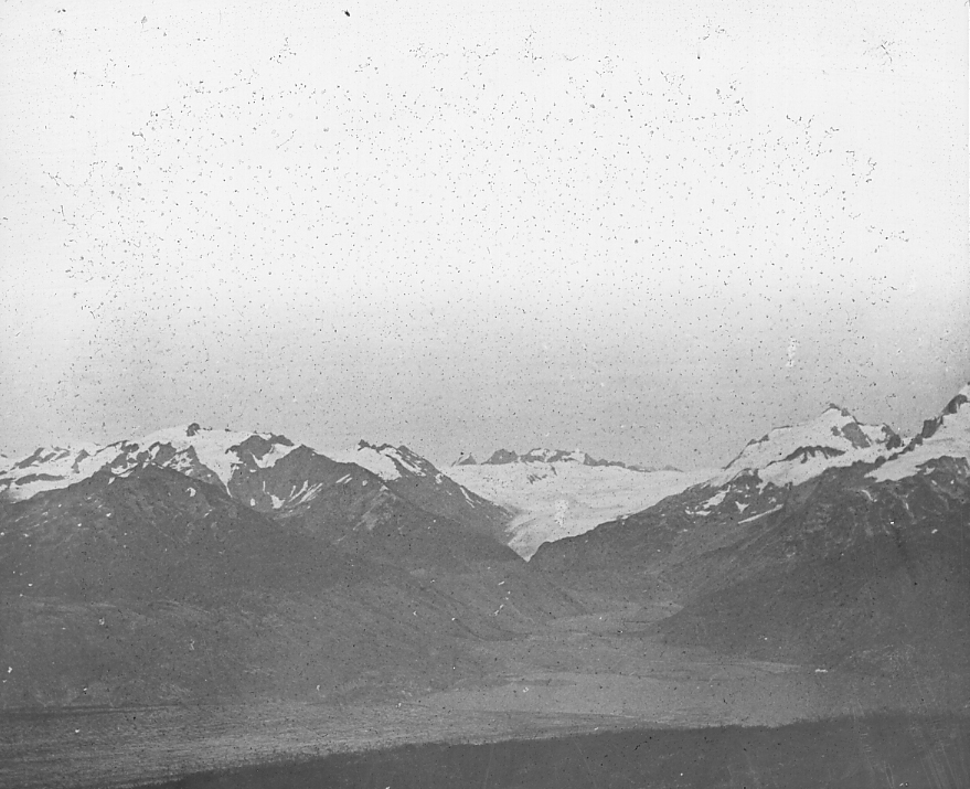
| 137.C.1 | Muir Glacier from Sebree Island, 1890. |
| 137.C.2 | End of Muir Glacier, August 1892. |
| 137.C.3 | End of Muir Glacier, September 1892. |
| 137.C.4 | Pinnacles at end of Muir Glacier. |
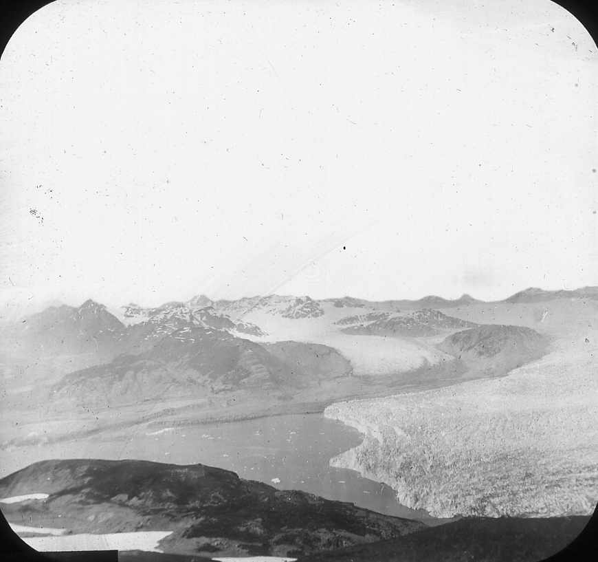
| 137.C.5 | Northeastern portion of Muir Glacier, Alaska. |
| 137.C.6 | Rock basin lake on a Nunatack, Muir Glacier, Alaska. |
| 137.C.7 | Endicott Lake, marginal to Muir Glacier, Alaska. |
| 137.C.8 | Endicott Lake, marginal to Muir Glacier, Alaska. 1890. |
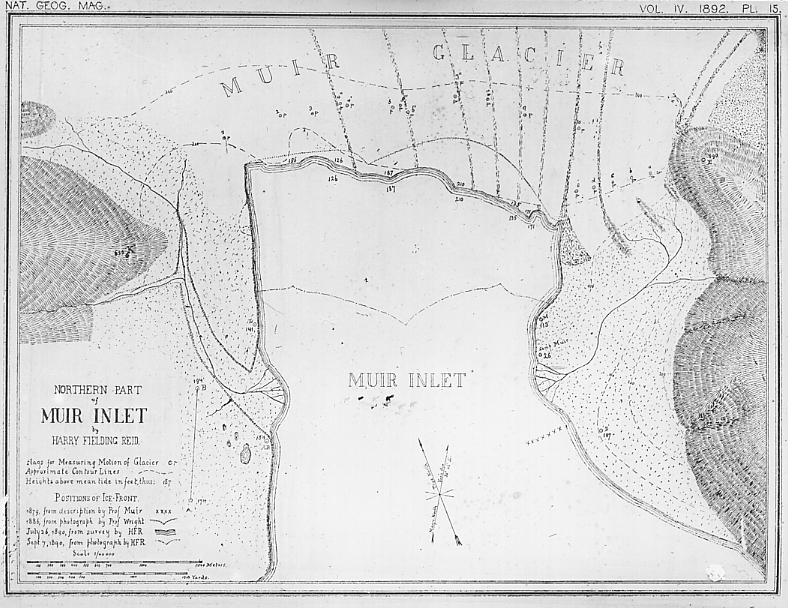
| 137.C.9 | Muir Glacier basin, after Reid. |
| 137.C.10 | End of Muir Glacier from Mt. Wright, Alaska. Sept. 1890. |
| 137.C.11 | End of Muir Glacier, July 1892. |
| 137.C.12 | Logan Glacier, with moraines. North side of St. Elias Range, Alaska. |
| 137.C.13 | Logan Glacier, with moraines. North side of St. Elias Range, Alaska. |
| 137.C.14 | Crevasse, Logan Glacier, Alaska. |
| 137.C.15 | White Glacier, tributary to Muir Glacier, Alaska. |
| 137.C.16 | Rendu Glacier, Glacier Bay, Alaska. |
| 137.C.17 | Davidson Glacier, Lynn Canal, Alaska. |
| 137.C.18 | Davidson Glacier, Lynn Canal, Alaska. |
| 137.C.19 | Taku Glacier, Alaska. |
WESTERN UNITED STATES |
|
| 137.D.1 | Whitney Glacier, northern side of Mt. Dana, California. |
| 137.D.2 | Crevasses, Whitney Glacier, Mt. Dana, California. |
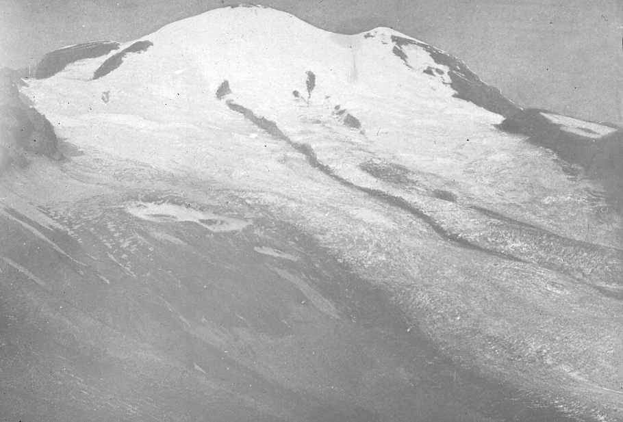
| 137.D.3 | The summit and eastern slope of Mt. Rainier, showing source of Emmons Glacier. 18th Ann., part 3. |
| 137.D.4 | Hotlum Glacier and Moraine, east slope of Mt. Shasta, California. |
GLACIER NATIONAL PARK |
|
| 137.E.1 | Glacier National Park. Grinnel Glacier. Waterfall between lower and upper glaciers 300′ high. In 1890 Glacier much larger and continuous with highest snow mass at left on ridge top. Present glacier a mere shrunken remnant occupying cirque head. |
| 137.E.2 | Glacier National Park. Grinnel Glacier. Looking south along terminus of glacier. The waterfalls in foreground of 137.E.1 are at the left. Sedimentary rocks dipping right. |
| 137.E.3 | Glacier National Park. Grinnel Glacier. The edge of the glacier. |
| 137.E.4 | Glacier National Park. Grinnel Glacier. The melting edge of glacier, resting on striated rock ledges. Lateral moraine in distance. |
| 137.E.5 | Glacier National Park. Grinnel Glacier. The melting edge of the glacier; ice caves. Lateral moraine in distance. |
| 137.E.6 | Glacier National Park. Grinnel Glacier. Terminal moraine nod abandoned a few rods below present edge. Stream from glacier. |
| 137.E.7 | Glacier National Park. Grinnel Glacier. Terminal moraine at edge of glacier. two largest boulders shown in 137.E.8 (right) and 137.E.9 (left). |
| 137.E.8 | Glacier National Park. Grinnel Glacier. Striated limestone boulder shown on right in slide 137.E.7. |
| 137.E.9 | Glacier National Park. Grinnel Glacier. Striated limestone boulder shown on left in slide 137.E.7. This boulder was still surrounded by glacier ice in 1920. The ice edge is now 200 yards farther back. |
| 137.E.10 | Glacier National Park. Grinnel Glacier. Striated bed rock with rock debris, uncovered about 1925. |
| 137.E.11 | Transverse Crevasse. |
| 137.E.12 | Glacier National Park. Grinnel Glacier. Ascending the 300′ rock wall behind the lower glacier. |
| 137.E.13 | Glacier National Park. Grinnel Glacier. Ascending the 300′ rock wall behind the lower glacier. Upper glacier in sight. Camera tipped upward. |
| 137.E.14 | Glacier National Park. Grinnel Glacier. Upper Glacier. Beginning the ascent. |
| 137.E.15 | Glacier National Park. Grinnel Glacier. Upper glacier. Horizontal banding of the ice due to horizontal thrusting of sheets. |
| 137.E.16 | Glacier National Park. Grinnel Glacier. Ascent of the 600′ cirque wall behind the glacier. |
| 137.E.17 | Glacier National Park. Grinnel Glacier. From top of 600′ cirque wall, Mt. Gould. Slide 137.E.18 is to left of this view. |
| 137.E.18 | Glacier National Park. Grinnel Glacier. Col above which is on left in Slide 137.E.17. This is the lowest notch on the sky line of slide 137.E.1 and 137.E.26. Arctic drainage left, Pacific right. |
| 137.E.19 | Glacier National Park. Grinnel Glacier. View from near same position as slide 137.E.1 and from same altitude, camera turned to left. Mt. Gould and edge of Grinnel Glacier at its base and right. In the depths and not shown, a beautiful glacial lake. |
| 137.E.20 | Glacier National Park. Grinnel Glacier. From same position as Slide 137.E.19, camera more to left. A glacial valley with three hanging cirques. Mt. Siyeh left, Going-to-Sun center, Piegan Pass right. |
| 137.E.21 | Glacier National Park. Summit of Stark’s Point from arrete to Mt. Grinnell. Arrete and cirque wall, glacial valley to right, Lake Josephine at bottom. |
| 137.E.22 | Glacier National Park. S.E. slope of Mt. Grinnell from same position as slide 137.E.21, turned 180 degrees. |
| 137.E.23 | Glacier National Park. N. Slope of Mt. Grinnell, from same position as slide 137.E.22, turned to right, into Swift Current Valley. |
| 137.E.24 | Glacier National Park. Topographic map of U.S. Geological Survey, showing glacial dissection. The trace of the Lewis overthrust is shown. |
| 137.E.25 | U-shaped glacial valley, Lake McDermott and Josephine, Mt. Gould 5 miles distant in center, Grinnel Glacier in extreme right distance. Many Glaciar Hotel, Glacier National Park, Mont. |
| 137.E.26 | Grinnel Glacier. Notch in Continental Divide, 2700 ft. above lake shown in slide 137.E.18. 300 ft. cliff in middle of glacier shown in 137.E.12 and 13. 600 ft. cliff below notch shown in slide 137.E.16. |
| 137.E.27 | U-shaped glacial valley, Swift Current Valley. Mt. Wilbur right, Swift Current Mt. in center. Many Glacier Region, Glacier National Park, Mont. |
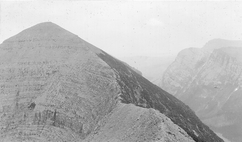
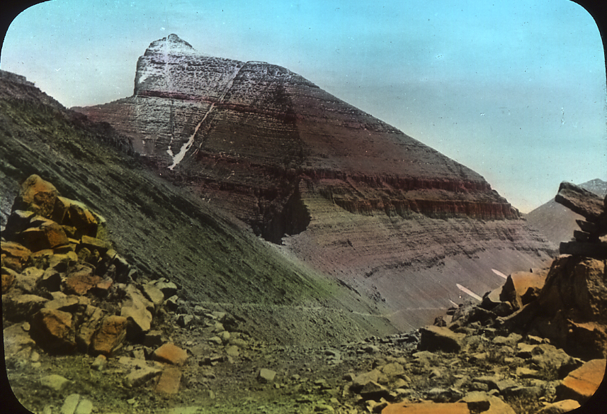
| 137.E.28 | Cirque cutting and col. Eastward to Mt. Siyeh (10,004 alt.) at left. Trail to Going-to-Sun. Glacier National Park, Mont. Slide 137.E.29 is from this station looking 90?? to right (South). Siyeh Limestone of Belt Series, 2800 ft. from col to mountain top. |
| 137.E.29 | Glacial topography. View S. from Piegan Pass (same station as 137.E.28). Peaks from right to left are Reynolds, Fusilade, Citadel and Mt. Logan, the last 8 miles distant, Blackfoot Glacier in distant center. |
| 137.E.30 | Glacial topography. View N. to Mt. Cleveland (10438 alt.) left, Glen Lake alt. 4869. Glacier National Park, Mont. |
| 137.E.31 | Glacial topography. South along Continental Divide. Mt. Gould at left. The notch directly in front of it is shown in slide 137.E.16. Granite Park. |
PIEDMONT |
|
| 139.-.1 | Central portion of Malaspina Glacier, Alaska. |
CONTINENTAL |
|
| 141.1 | Ice sheet, interior of Greenland. Photo by Nordenskiold. |
LOAD, GLACIAL MORAINES |
|
| 149.-.1 | Muir Glacier over-riding gravels. Alaska, 1890. |
| 149.-.2 | Moraine on Muir Glacier, Alaska. |
| 149.-.3 | Moraine covered portion of Malaspina Glacier, Alaska. |
| 149.-.4 | Forest growing on moraine of Malaspina Glacier, Alaska. |
| 149.-.5 | Morainic lakes in the Rocky Mountains, Colorado. |
| 149.-.6 | Small glacier tributary to dirt glacier, in Muir Glacier Basin, Alaska. |
LOAD, GLACIAL-FLUVIATILE |
|
| 151.-.1 | General view of the Yahtse gravel delta, Alaska. |
| 151.-.2 | Yahtse River, issuing from a tunnel in Malaspina Glacier. The bluffs are of dirt-covered ice. Alaska. |
EROSION |
|
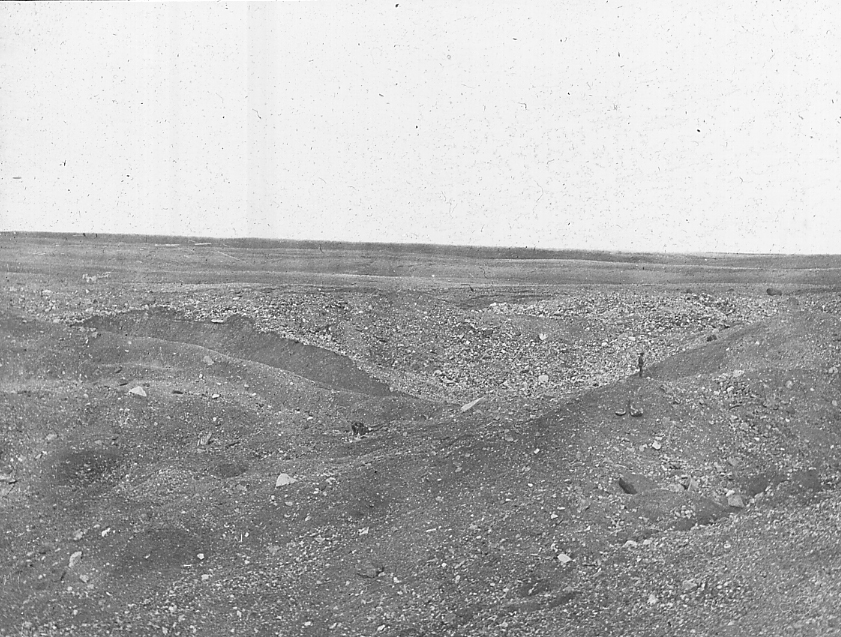
| 153.-.1 | Glacial scratches on Sebree Island, 3 miles below Muir ice front of 1890. |
EFFECTS OF ALPINE GLACIERS |
|
ALPINE GLACIER TOPOGRAPHY |
|
| 157.A.1 | Lake Canon partly refilled after being glaciated , near Momo Lake, Calif. |
SWISS ALPS |
|
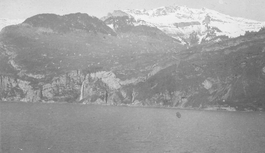
| 157.B.1 | Hanging valley. Wallensee, Switzerland. |
| 157.B.2 | The Matterhorn, from east Zermatt on right, Switzerland. |
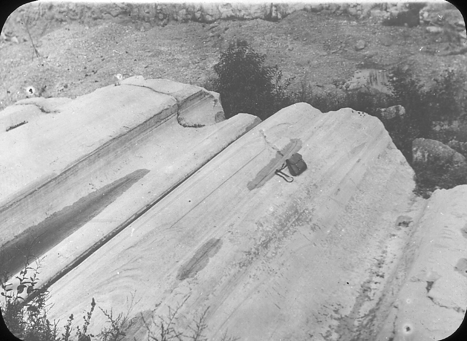
| 157.B.3 | Glacial Scratches and Glacial Boulders, Gletschergarten, Luzern, Switzerland. |
| 157.B.4 | Eroded till deposits. Val d’Herens, a valley flowing north from the Matterhorn. |
BIG HORN MOUNTAINS |
|
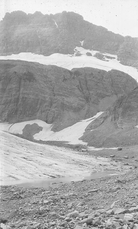
| 157.C.1 | Glacial cirque and lake, head of Little Timber Creek, Montana. |
| 157.C.2 | Cirque with glacier at foot of Cloud Peak, Big Horn Mountains, Wyo. |
| 157.C.3 | Cirque with lake, head of Tensleep Creek, Big Horn Mountains, Wyo. |
YOSEMITE, SIERRA NEVADA |
|
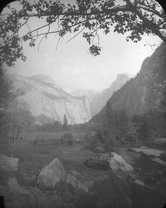
| 157.D.1 | Yosemite Valley, California. |
| 157.D.2 | Cathedral Rocks and Bridal Veil Falls, Yosemite Valley, California. |
| 157.D.3 | Bridal Veil Falls, Yosemite Valley California. |
| 157.D.4 | Sentinal Cliff, King’s River, California. |
| 157.D.5 | Home of Storm Gods, Yosemite valley, California. |
| 157.D.6 | Bridal Veil Falls, Yosemite Valley, California. |
| 157.D.7 | View eastward up Yosemite Valley toward the crest of the Sierra Nevada. From airplane. The Sierra Nevada peneplain, Mesozoic and Tertiary in age, lifted about end of Pleistocene. |
ALASKA AND BRITISH COLUMBIA |
|
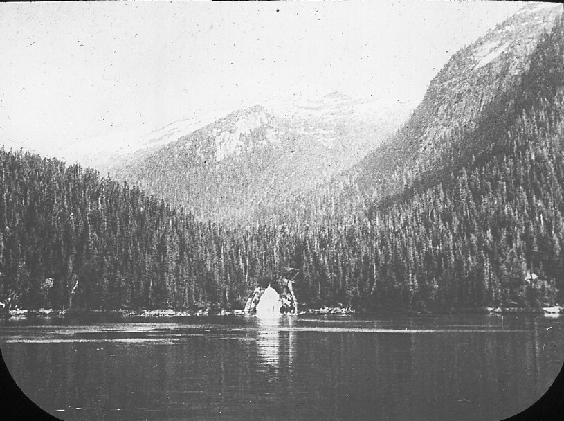
| 157.E.1 | Hanging valley, inside passage, Frazer Reach, British Columbia. |
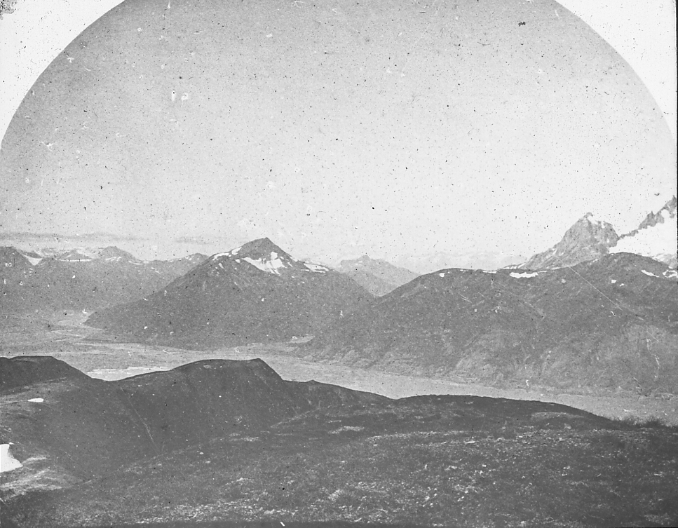
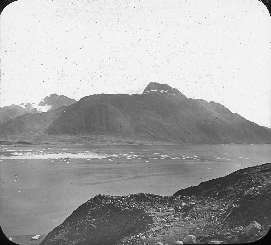
| 157.E.2 | Mounts Case and Wright, Muir Glacier, Alaska. |
| 157.E.3 | Front of Muir Glacier, from Nunatak Glacier, Alaska, 1890. |
NORWAY FIORD |
|
| 157.F.1 | Geiranger Fiord and hanging valley; Romsdal-Amt, Norway. |
| 157.F.2 | Nara Fiord, Norway |
EFFECTS OF CONTINENTAL GLACIERS |
|
STRIAE |
|
| 163.A.1 | Glacial striae on limestone. Iowa. |
| 163.A.2 | Glaciated rock surface near Eastport, Maine. |
| 163.A.3 | Glaciated rocks, southeastern slope of Mt. Shasta, California. |
| 163.A.4 | Glaciated summit of Mt. Monadnock, New Hampshire. |
| 163.A.5 | Glaciated Berea Grit. S. Amherst, Ohio. |
| 163.A.6 | Stream worn pot-hole in hill of gneiss, result of glacial stream. 20 miles north of Kingston, Ontario. |
KELLEY’S ISLAND |
|
| 163.B.1 | Glacial striae on Onondaga limestone, Kelley’s Island, Ohio. |
| 163.B.2 | Glacial grooves, Kelley’s Island, Ohio. |
TILL |
|
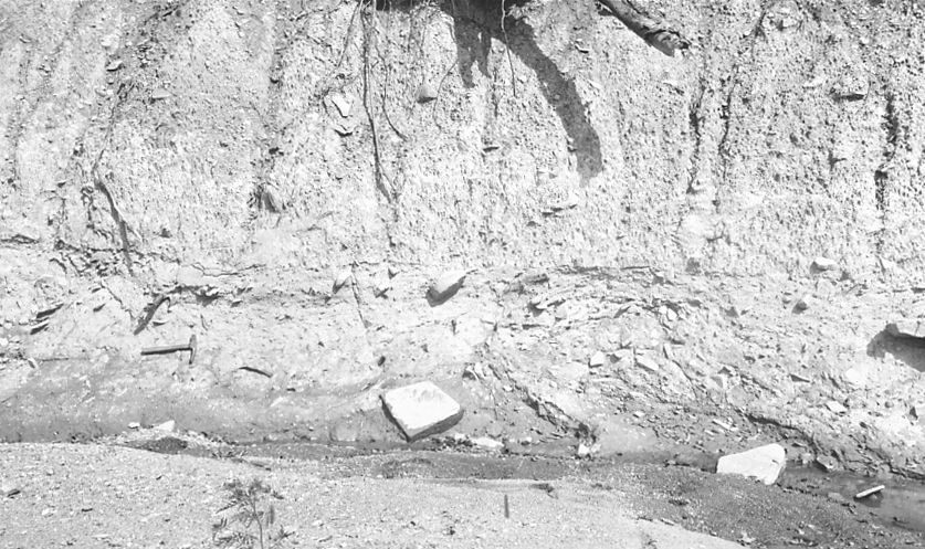
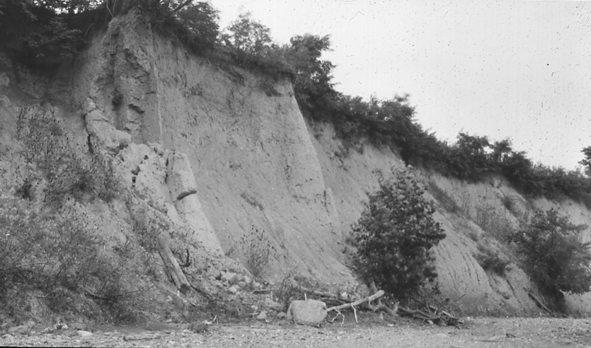
| 165.-.1 | Stony till. Lower half washed clean by stream, upper half shows rain wash. Chillicothe, Ohio. |
| 165.-.2 | Till, late Wisconsin. Chillicothe, Ohio. |
| 165.-.3 | Till resting on Newark Trap, Newark, New Jersey. |
| 167.A.1 | Glacial erratics |
| 167.A.2 | Glacial erratics |
MORAINES |
|
| 169.A.1 | Terminal moraine. Mystic Pond, Cape Cod, Massachusetts. |
| 169.A.2 | Terminal moraine topography, near Oconomowoc, Wisconsin. |
| 169.A.3 | Inner face of terminal moraine, North Almond Valley, New York. |
JACKSON, MICHIGAN |
|
| 169.B.1 | Kettle holes, morainic topography. Jackson, Michigan. |
| 169.B.2 | Morainic topography; Jackson, Michigan. |
| 169.B.3 | Morainic topography; Jackson, Michigan. |
CHILLICOTHE, OHIO |
|
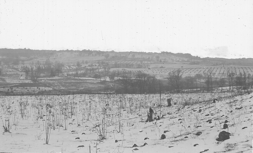
| 169.C.1 | Terminal moraine, late Wisconsin ice sheet. Drift in view is about 100 feet thick. Northeast of Chillicothe, Ohio. |
| 169.C.2 | Terminal moraine of Late Wisconsin ice sheet. At no place in the view could bed-rock be encountered at less than 100 feet. Chillicothe. |
| 169.C.3 | Till-filled pre-glacial outlet of Paint Creek. Wells have penetrated 160 feet into the filling without encountering the rock floor. Foreground and distant hills are rock walls. 2 miles north of Chillicothe, Ohio. |
| 169.C.4 | Basin of North Fork, Paint Creek. Till-filled to about 100 feet. Distant hills are rock, the Allegheny Plateau; notch in center horizon is post-glacial gorge of North Fork, Paint Creek at Mussleman. frankfort, Ross County, Ohio. |
| 169.C.5 | Moraine of weak character. Chillicothe, Ross County, Ohio. |
| 169.C.6 | Kettle hole in moraine of No. 169.C.3 2 miles north of Chillicothe, Ohio. |
BURTON, GEAUGA COUNTY, OHIO |
|
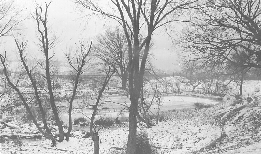
| 169.D.1 | Morainic topography. Lake Punderson, 3 miles S.W. Burton, Ohio. |
| 169.D.2 | Morainic topography. Lake Punderson, 3 miles S.W. Burton, Ohio. |
| 169.D.3 | Morainic topography near Lake Punderson, 2 miles S.W. Burton, Ohio. See also slide 297.-.11 |
TILL PLAINS |
|
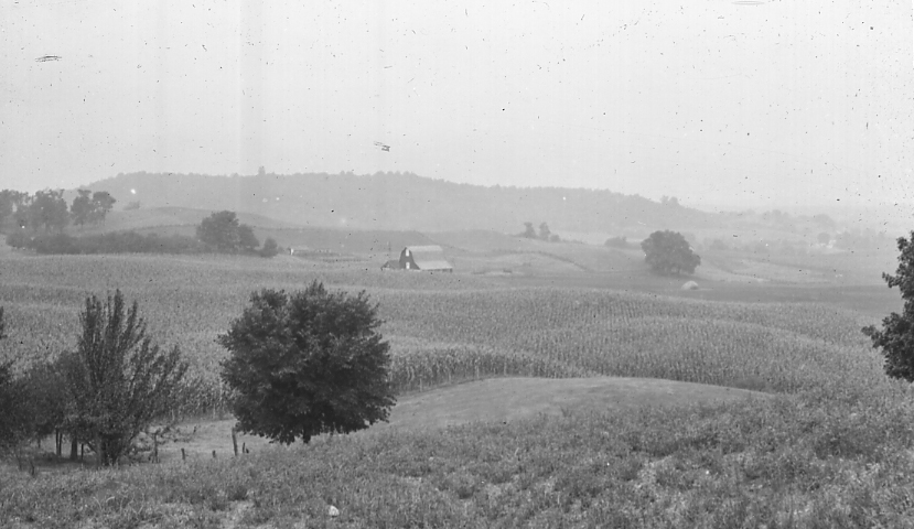
| 173.-.1 | Till plain near Columbus, Ohio. |
DRUMLINS |
|
| 175.-.1 | Drumlin near Groton, Massachusetts. |
| 175.-.2 | Drumlin near Ipswich, Massachusetts. |
GRAVELS AND SANDS |
|
| 177.-.1 | Stratified glacial gravels. Newberg, Cleveland, Ohio. |
| 177.-.2 | Stratified drift. Sand of old delta of Cuyahoga River. Cleveland, Ohio. |
KAMES |
|
| 179.-.1 | Kame moraine, Wisconsin (late) ice sheet. Drift 100 to 200 feet deep. Distant hill is margin of Allegheny Plateau, which stopped the ice. West of Chillicothe, Ross County, Ohio. |
| 179.-.2 | Kame moraine topography. Chillicothe, Ohio. |
| 179.-.3 | Kames, 160 ft high. Chillicothe, Ohio. |
ESKERS |
|
| 181.-.1 | An esker in Auburndale, near Boston, Mass. |
| 181.-.2 | Esker, North Adams, Mass. |
OUTWASH PLAINS |
|
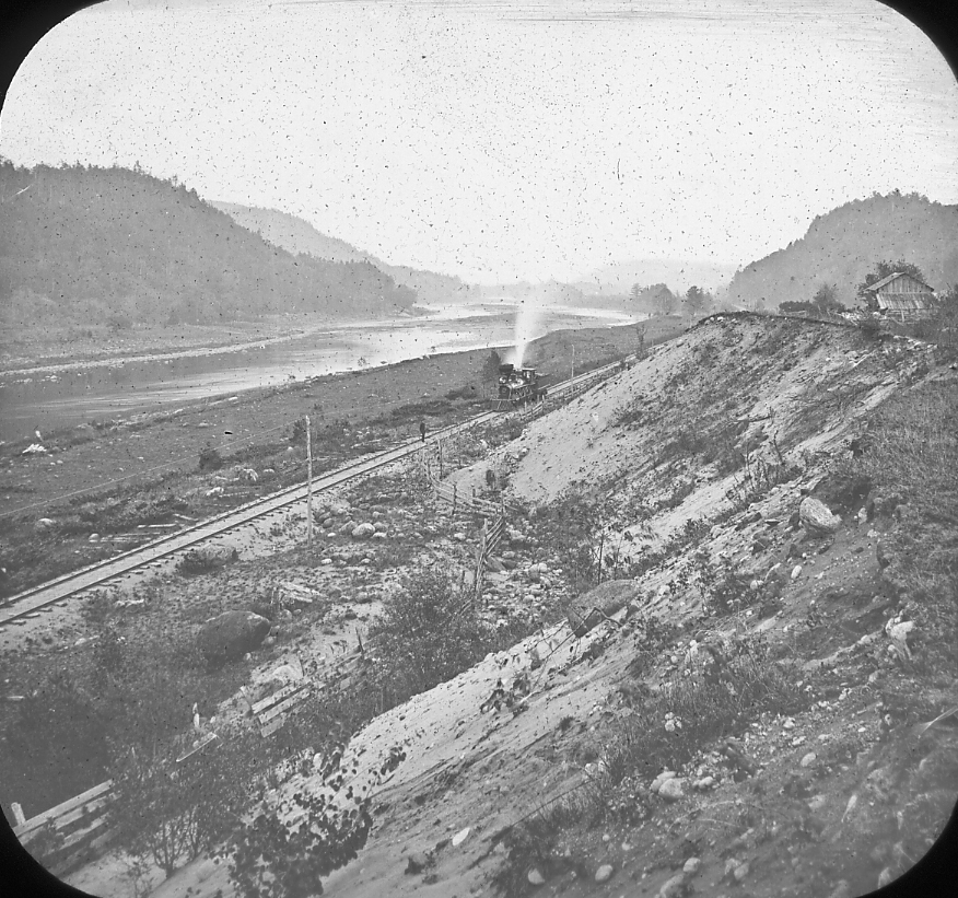
| 183.-.1 | The Hudson River near the Glen; Warren County, New York. |
| 183.-.2 | Plain of glacial gravels and sand. Cape Cod, Mass. |
TERRACES |
|
| 185.-.1 | Terrace of late Wisconsin gravel, very slightly dissected at margin, much older Illinoian in distance. Scioto River, Chillicothe, Ohio. |
| 185.-.2 | Looking across undissected surface of late Wisconsin gravel terrace (shown in No. 185.-.1) to deeply weathered and dissected Illinoian terrace. Chillicothe, Ohio. |
| 185.-.3 | Looking across dissected surface of Illinoian terrace shown in no. 185.-.1. Depth of gravel over 100 feet at least. Chillicothe, Ohio. |
DRAINAGE CHANGES |
|
| 189.-.1 | Gorge of the Mohawk River at Little Falls New York. |
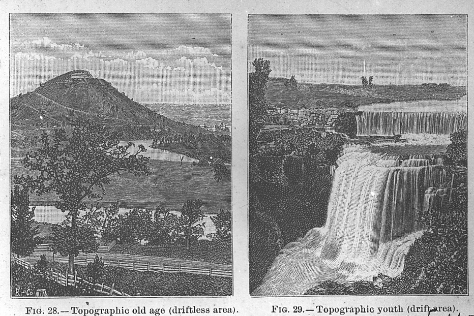
| 189.-.2 | Topographic youth and old age. After Chamberlain. |
ICEBERGS |
|
| 195.-.1 | Icebergs in Glacier Bay, Alaska. |
| 195.-.2 | Icebergs in Baffin’s Bay. |
LAKE AND SEA ICE |
|
| 197.-.1 | Pack Ice, Baffin’s Bay. |