General Orogeny | Plains and Plateaus | United States Coastal Plain | Great Plains of United States | Plateaus | Mountains | Adirondacks | Rocky Mountains, Colorado | Basin Ranges | Sierra Nevada | Alaskan Ranges | Swiss Alps | Appalachians
GENERAL OROGENY
| 485.-.1 | The Tertiary belt of mountain folding and the depths of the ocean. |
| 485.-.2 | Map of Western United States. (Lobeck) |
PLAINS AND PLATEAUS |
|
| 501.-.1 | Topography of plains of northern France and Belgium. D.W. Johnson. |
UNITED STATES COASTAL PLAIN |
|
| 501.B.1 | Coastal Plain near Lakewood, New Jersey. Recently emerged sea bottom. |
| 501.B.2 | Characteristic topography and vegetation of coastal sand plain, Pernambuco, Brazil. |
| 501.B.3 | Great falls of the Potomac River at Fall line. |
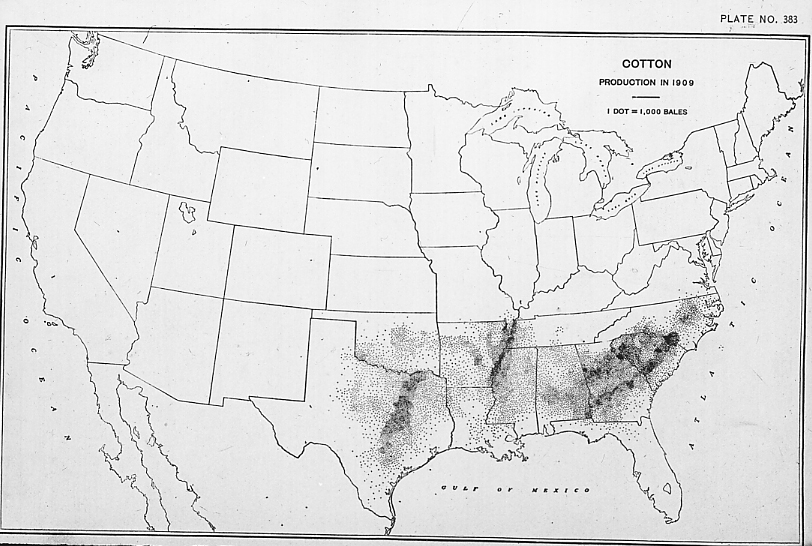
| 501.B.4 | Coastal plain of southeastern United States; shows production of cotton. Census, 1910. |
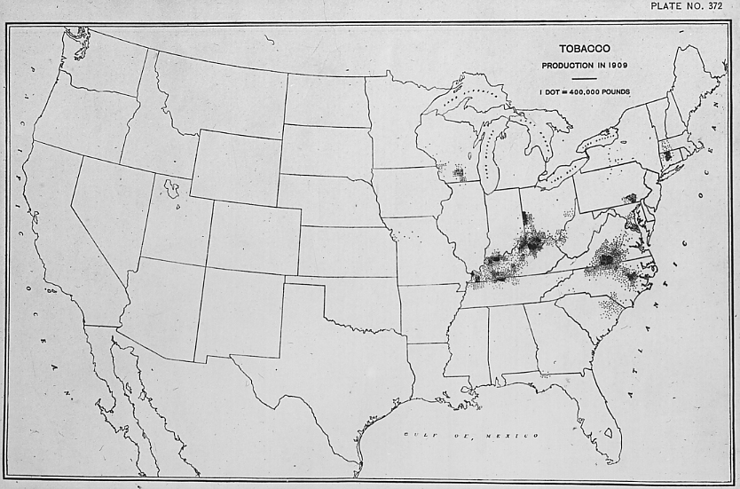
| 501.B.5 | Coastal plain of southeastern United States; shows production of tobacco. Census, 1910. |
| 501.B.6 | Coastal plain of southeastern United States; shows percentage of Negro population. Census, 1910. |
| 501.B.7 | Coastal plain, southeastern United States. Farms 3 to 9 acres in extent. Census, 1910. |
| 501.B.8 | Coastal plain, southeastern United States. Farms 20 to 40 acres in extent. Census, 1910. |
| 501.B.9 | Coastal plain, southeastern United States. Farms 100 to 174 acres in extent. Census, 1910. |
| 501.B.10 | Coastal plain, southeastern United States. Farms operated by owners. Census, 1910. |
| 501.B.11 | Coastal plain, southeastern United States. Farms operated by tenants. Census, 1910. |
| 501.B.12 | Coastal plain, southeastern United States. Farms operated by negro tenants. Census, 1910. |
| 501.B.13 | Coastal plain. Literacy among native whites, Cotton Belt. Census 1910. |
GREAT PLAINS OF UNITED STATES |
|
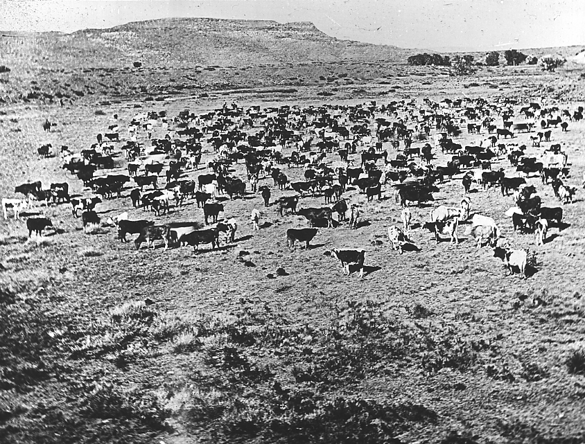
| 501.C.1 | The Great Plains between the Platte and Arkansas Rivers, Colorado. |
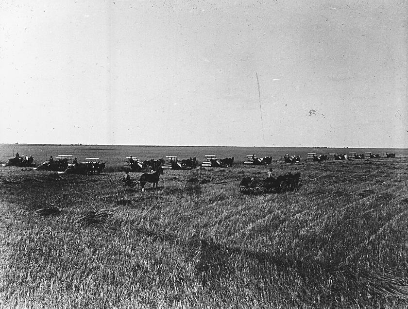
| 501.C.2 | Great Plains, floor of Lake Agassiz; harvesting scene, Traill County, North Dakota. |
| 501.C.3 | Rolling, grass-covered surface of Great Plains, North Dakota. |
| 501.C.4 | The Great Plains in the dry climate of eastern Montana. |
| 501.C.5 | The Llano Estacado of Western Texas. |
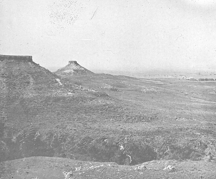
| 501.C.6 | Cuesta escarpment of the High Plains and an outlier. Antelope Butte, Texas. Physiog. Atlas, 3. |
| 501.C.7 | A remnant summit of the Callahan Divide. Signal Butte, Howard County, Texas. Physiog. Atlas, 3. |
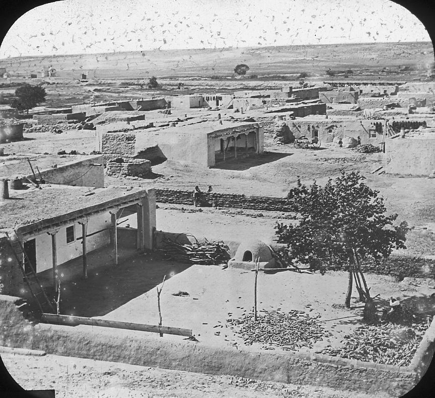
| 501.C.8 | Great Plains. Pueblo Iseta, Panorama, New Mexico. |
PLATEAUS |
|
| 511.-.1 | High arid plateau. Queretaro, Mexico. |
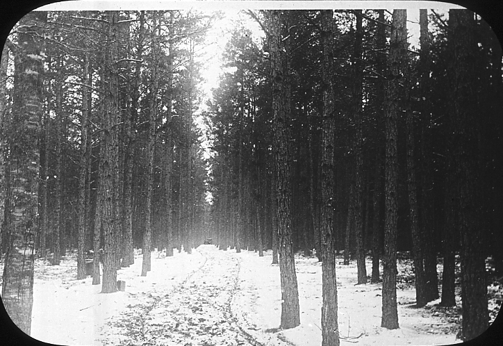
| 511.-.2 | Wittemburg Range, southern Catskills, 1/2 mile east of Shokan station, looking west. New York. |
| 511.-.3 | Dissected plateau of Blue Ridge, at head of New River, North Carolina. |
| 511.-.4 | Allegheny Plateau and Helderberg escarpment, Indian Ladder, Albany, N.Y. |
| 511.-.5 | Cuesta escarpment. Looking toward cliffs from south of Virginia City, Utah. |
MOUNTAINS |
|
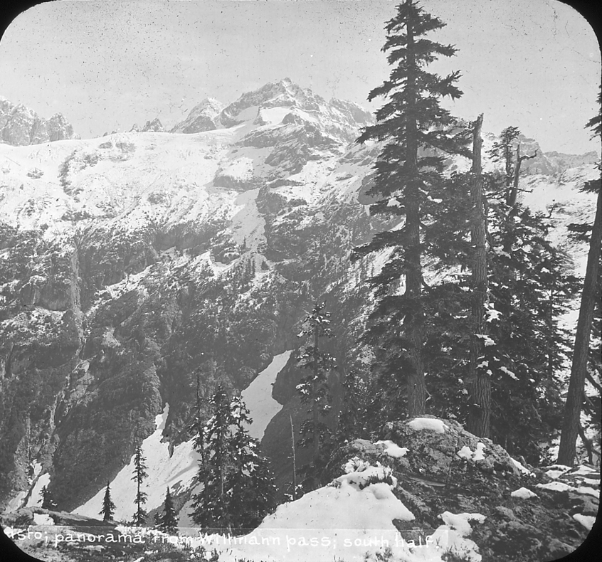
| 531.A.1 | Panorama from Willman Pass, Monte Cristo, Cascade Mtns, Washington. |
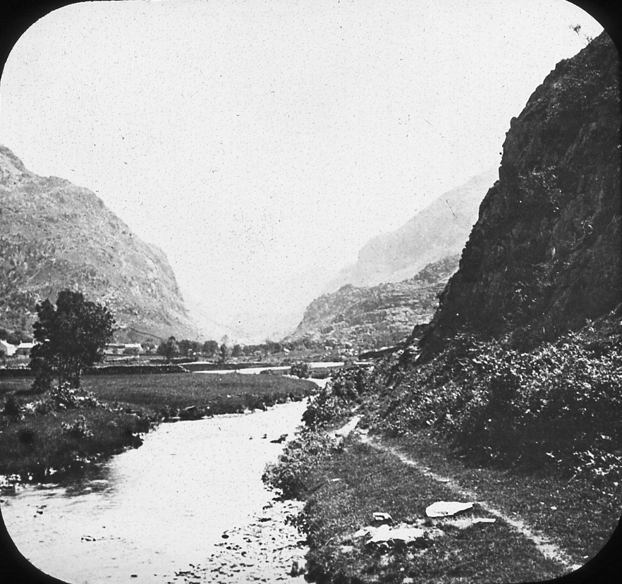
| 531.A.2 | In the Pass of Llanberis, Wales. |
| 531.A.3 | Kwen Lun Mountains, East Turkestan. |
ADIRONDACKS |
|
| 531.B.1 | Looking east at the high Adirondacks, from hill north of alcohol factory, Tupper Lake, New York. |
| 531.B.2 | Adirondacks from Huberts Inn. |
ROCKY MOUNTAINS, COLORADO |
|
| 531.C.1 | Torrey’s and Gray’s Peaks, Rocky Mountain Front Range, Colorado. |
| 531.C.2 | Mt. Ouray, Colorado. |
| 531.C.3 | Sultan Mountain from Baker’s Park. |
| 531.C.4 | Long’s Peak from Este’s Park, Colorado. |
| 531.C.5 | Spruce cut out by snow slide. Brush Creek, Gunnison County, Colorado. |
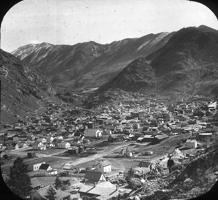
| 531.C.6 | Georgetown, Colorado. |
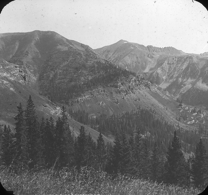
| 531.C.7 | Pearl Mtn. in center; 13,484 feet; Elk Mtns., Gunnison County, Colorado. Brush Creek Valley. |
BASIN RANGES |
|
| 531.D.1 | View of section of White Mountain range, Inyo County, California. |
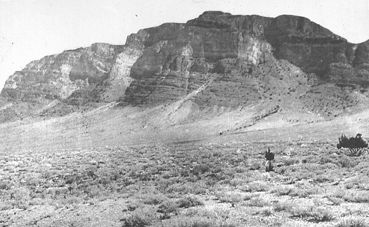
| 531.D.2 | A block-like mountain of the Great Basin; front or steep face of the House Range. |
SIERRA NEVADA |
|
| 531.E.1 | The Summit of the Sierra Nevada near Tower Peak, Tuolumne County, Cal. |
| 531.E.2 | Sierra Nevada from Alvord station, 2 miles east of Big Pine, Inyo County, California. |
| 531.E.3 | West peak of Mt. Raymond; of andesite breccia. Sierra Nevada, Alpine County, California. |
ALASKAN RANGES |
|
| 531.F.1 | Inland view of St. Elias Range from White River Basin, Alaska. |
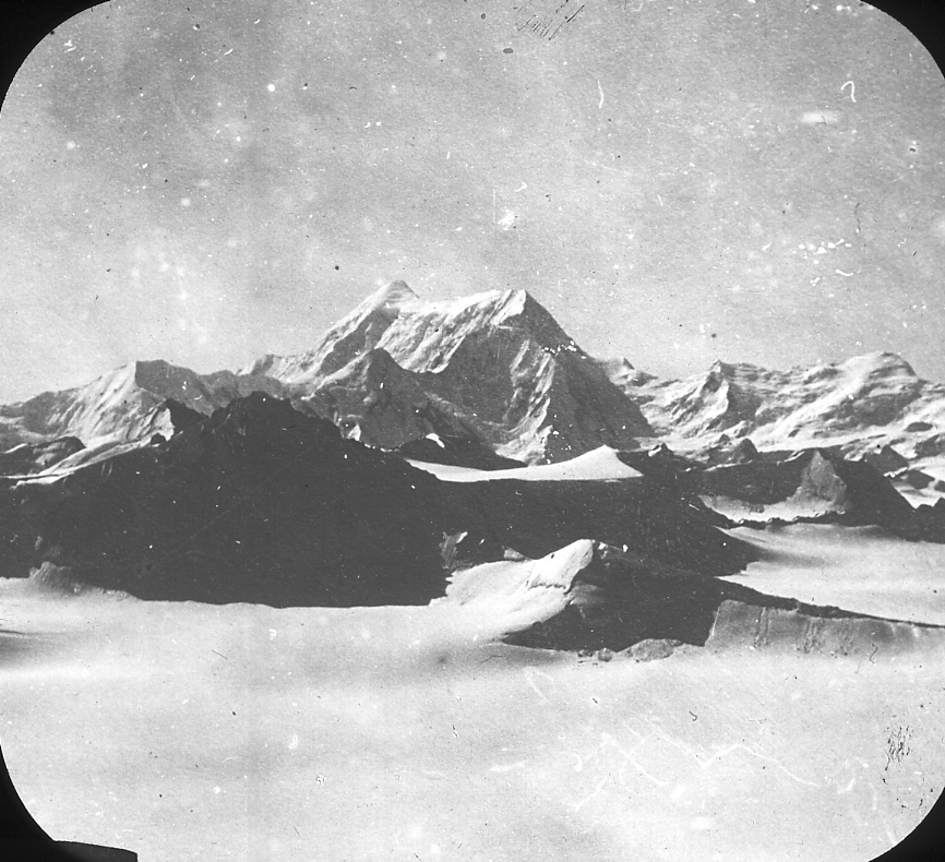
| 531.F.2 | Looking northward from the Malaspina Glacier toward Mt. St. Elias, Alaska. |
| 531.F.3 | Mt. St. Elias from the north. Alaska. |
SWISS ALPS |
|
| 531.G.1 | Looking up Alpine valley toward the St. Gothard, 2 miles below Goeschenen, Switzerland. |
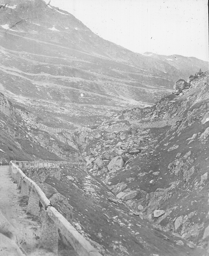
| 531.G.2 | Road zigzags over Grimsel Pass, Swiss Alps. |
| 531.G.3 | Curves in road down St. Gothard, near Schollenen. |
| 531.G.6 | Jura Mountains; plan, solid black lines are folds, the width proportioned to the strength of the fold. |
| 531.G.7 | Jura Mountains. Section across northeast end. No. 6 is through Basel, No. 10 through Lake Neuchatel. |
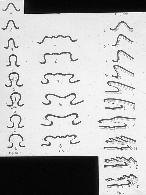
| 531.G.8 | The Alps. The successive stages in the development of three folds of different form. Essential to the understanding of Alpine structure. |
| 531.G.9 | The Alps. Plan of development of an overturned fold in the “Uberschiebungs decke” or overshoved “deck”. |
| 531.G.10 | The Alps. Diagramatic representation of the two theories, mushroom fold and “deck faulte” or “uberschiebungsdecke”. |
| 531.G.11 | The Alps. The Glarner fold, south of Wallensee, Province of Glarus, northeastern Swiss Alps, interpreted as a double fold and as a “deck” fold. See slide No. |
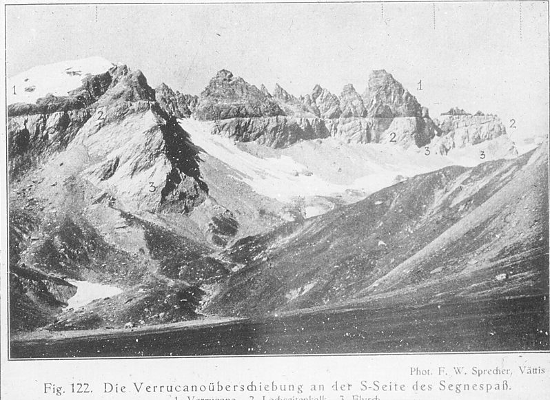
| 531.G.12 | The Alps. The Verrucano (Permian) overthrust on the Jurassic (Lochseitenkalk) and Flysch. Northeastern part of the Swiss Alps in Province of Glarus. See Glarner fold, slide no. |
| 531.G.13 | The Alps. Simplified schematic representation of the Alps as a result of three deckfaults. |
| 531.G.14 | The Alps. SS?ntis; eastern Swiss Alps, between Wallensee and Lake Constance. |
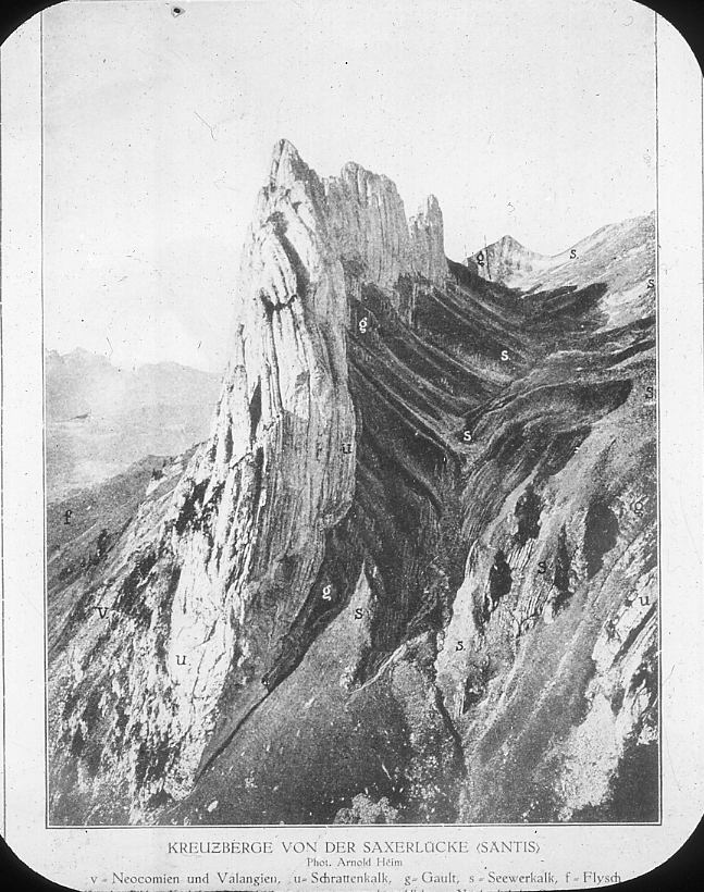
| 531.G.15 | The Alps. One of the peaks of the SS?ntis, the Kreuzberge. For position in the SS?ntis see slide no. at right of Sestion 2. |
| 531.G.16 | The Alps. SS?ntis group, eastern Swiss Alps between Wallensee and Lake Constance. View W.S.W., the Main Alps ranges in the distance, and lowland N. of Alps on right. |
| 531.G.17 | The Alps. The Matterhorn. |
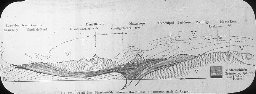
| 531.G.18 | The Alps. Profile through Dent Blanch, the Matterhorn and Monte Rosa. |
| 531.G.19 | The Alps. The Mithen. See slide No. |
| 531.G.20 | The Alps. The Mithen, showing two decken. Mesozoic in foreground, overlain by Flysch (early Tertiary) and that by folded Mesozoic. |
| 531.G.21 | Small portion of N.E. part, Jura Mts., 5×9 miles. See Moron, Graitry, and Montez anticlines on slide 531.G.6 where longitude line, passing between “Rhein” and “Tal”, cuts all three. See slide 531.G.22 for a map of this area. |
| 531.G.22 | Map of three anticlines in N.E. end of Jura Mts. See slide 531.G.21 for cross section and 531.G.6 for location. |
APPALACHIANS |
|
| 531.H.1 | Grit over Hudson shale. East face of Shawangukk Mtn., 2 miles S. of Lake Mohonk, New York. |
| 531.H.2 | Narrows of the Hudson River, New York. |
| 531.H.3 | Kittatinny Mountain and Delaware Water Gap. |
| 531.H.4 | Blue Ridge, and water gap of the Potomac River, junction of Potomac and Shenandoa. Harper’s Ferry, Virginia. |
| 531.H.5 | Junction of the Shenandoa and Potomac Rivers. |
| 531.H.6 | Diagram and sketch of a canoe-shaped valley in a plunging syncline. |
| 531.H.7 | Canoe-shaped valleys and drainage. Southern anthracite field. |
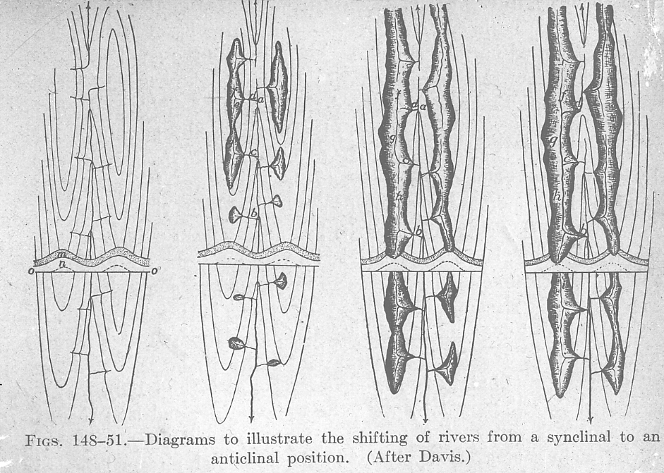
| 531.H.8 | Diagrams of river shifting from anticlinal to synclinal position. |
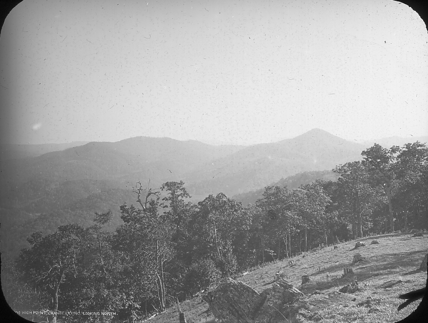
| 531.H.9 | Looking toward Asheville, from High Point, North Carolina. |
| 531.H.10 | West end of Grandfather Mountain, showing above Blue Ridge, N.C. |
| 531.H.11 | Hartz’s Ledge, and White Horse Ledge, White Mountains, North Conway, New Hampshire. |
| 531.H.12 | Anticline in Wills Creek formation (Cayugan), Upper Silurian, a clayey limestone (sometimes cement rock.) 15 miles S.E. of Allegheny Front, 45 S.E. of main axis of Allegheny Plateau Coal Fields. Alexandria, Pa. Main line Penna. R.R., 15 miles N.E. of Altoona. A minor fold on S.E. limb of westernmost great Anticline of Appalachians. |