Plugs | Dykes | Sills | Laccoliths | Bathyliths | Brewster County, Texas | Igneous Rocks. Composition
PLUGS |
|
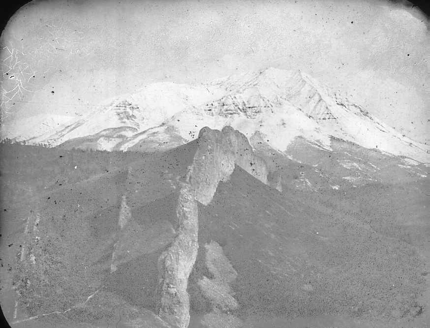
| 371.-.1 | Volcanic neck. The “Stock” or root of an ancient eruption. Mato-Tepe, Wyo. |
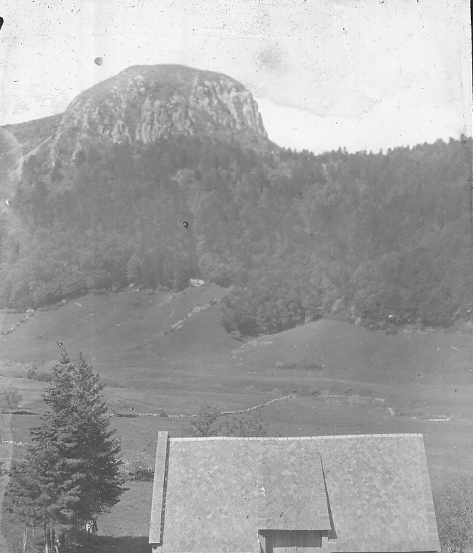
| 371.-.2 | Pic du Capucin, Valley of Dordogne, near Mt. Dore, Auvergne, France. |
| 371.-.3 | A volcanic plug. Bear Butte, Wyoming, from west near Black Hills. |
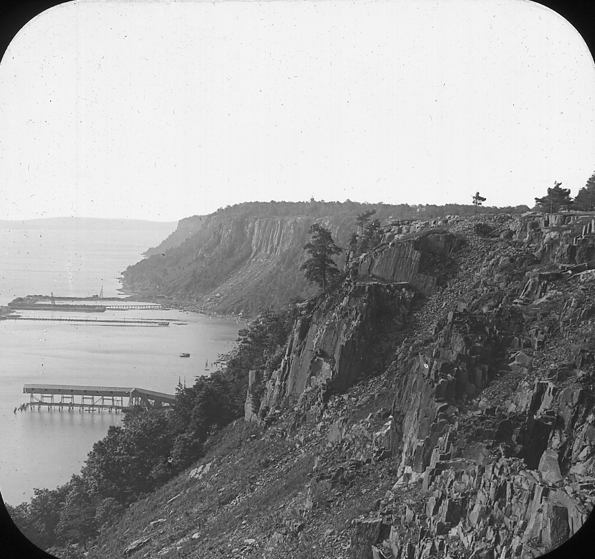
| 371.-.4 | Volcanic plug. Starks’ Knob, Schuylerville, N.Y., from southeast, after partial quarrying. September 1, 1910. H.P.C. |
| 371.-.5 | Volcanic plug. Starks’ Knob, Schuylerville, N.Y. Great horizontal shear zone near base of quarry on southeast side of plug. September 1, 1910. H.P.C. |
| 371.-.6 | Volcanic plug. Stark’s Knob, Schuylerville, N.Y. From east before opening. |
DYKES |
|
| 373.-.1 | Large dyke and smaller ones in foreground. West Spanish Peaks, from the northwest. New Mexico. |
| 373.-.2 | Distant view of great dyke. East Spanish Peak from the northwest. N. Mex. |
| 373.-.3 | Dyke 100 feet high. Near view of great dyke north of West Spanish Peak, New Mexico. From the northwest. |
| 373.-.4 | Dyke. Devil’s Slide, Utah. Transferred to 473.-.4 |
| 373.-.5 | Dykes near Hoodoo Mountain, Yellowstone Park, Wyo. |
| 373.-.6 | Worn out dyke; Pigeon Cove, Cape Ann, Mass. (9th Annual.) |
SILLS |
|
| 375.-.1 | Intrusive sill, Newark Series, Palisades, Hudson River, New Jersey. |
| 375.-.2 | Triassic trap sheet dipping to left (south). Mt. Tom Range from Holyoke, Massachusetts. |
| 375.-.3 | Trap flow on sandstone; Newark Series, City Quarry, Hartford Conn. 18th Annual; part 3. |
| 375.-.4 | Upper surface of lower lava flow; is vesicular flow above solid Newark Series. Lane’s Quarry, Meriden, Conn. 18th Ann, Part 3. |
LACCOLITHS |
|
| 377.-.1 | Dome shape due to buried laccolite. Green Mt., Wyoming. |
| 377.-.2 | Diagram of laccolith. Black Hills district, South Dakota. |
BATHYLITHS |
|
| 379.-.1 | Granite cutting amphibolite; glaciated surface; Animas Canyon, Wyo. |
| 379.-.2 | Amphibolite inclusions in Pre-Cambrain bathylith; Needle Mts. Colo. |
| 379.-.3 | Greenville green schist intricately cut by granite; both lit-par-lit and mosaic types. Near St. Lawerence, Foster’s Landing, N. Y. (Jefferson County) |
| 379.-.4 | Algomian granite, (Middle Huronian) with Lower Huronian schist inclusions. Crane Lake, Northern Minnesota. |
BREWSTER COUNTY, TEXAS |
|
| 381.A.1 | Volcanic tuff beds, a dyke in immediate foreground; 2 mile distant and right of center, a plug on center of mile-long dyke. Alamo Creek, 35 mile south Alpine, Brewster County, Texas. |
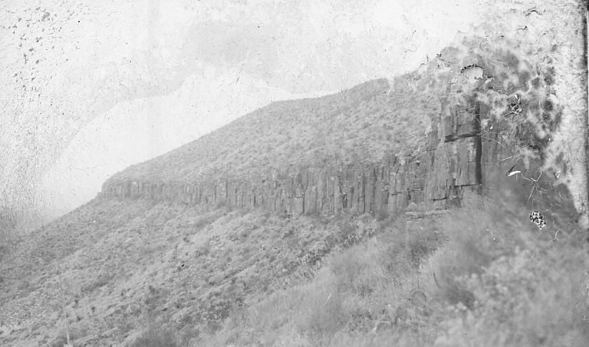
| 381.A.2 | Sill in limestone. Brewster County, Texas. |
| 381.A.3 | Sill in limestone with included block of limestone. Cedar Creek, 9 pt. Mesa sheet, Brewster County, Texas. |
| 381.A.4 | Sill in limestone, Cedar Creek, 9 pt. Mesa Sheet, Brewster County, Tex. |
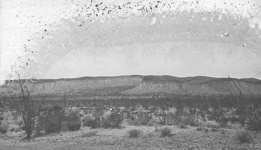
| 381.A.5 | A laccolite with sharply upturned surrounding strata. Packsaddle Mt., Agua Fria sheet, 80 miles south Alpine, Brewster County, Texas |
| 381.A.6 | Laccolite, northeast corner Terlinga sheet, 80 miles south Alpine, Brewster County, Tex. Nos. and form a set. Gently arched beds over north end of laccolite. |
| 381.A.7 | Laccolite with inclined beds on east side dipping away from core, (shown in no. ) Beds are limestones with sills. 80 miles south of Alpine, Brewster County, Texas. Northeast corner of Terlinga, sheet. |
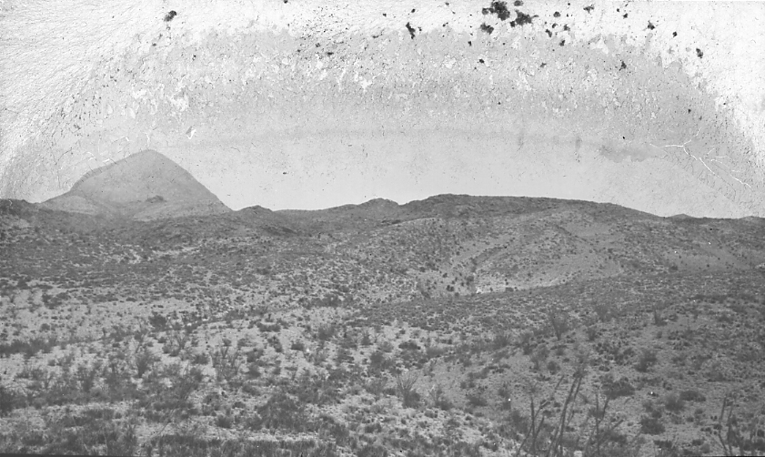
| 381.A.8 | Laccolite, northeast corner of Terlinga sheet. Center of sky-line igneous core, Cretaceous limestones overlying in three directions. Sharp peak on left another laccolite or plug. 80 miles south Alpine, Brewster County, Texas. |
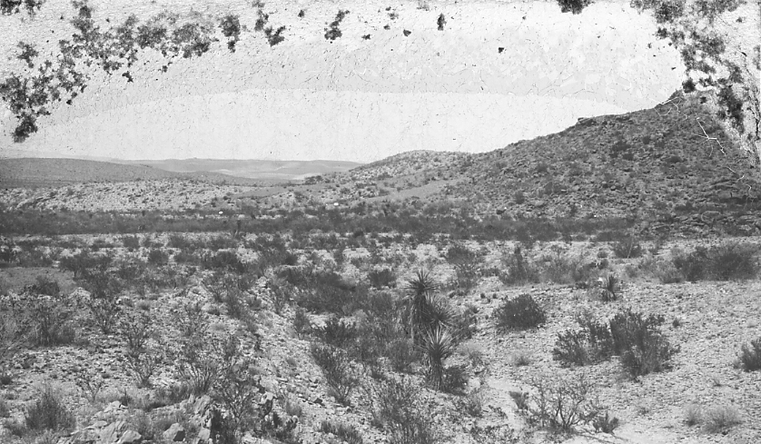
| 381.A.9 | Laccolite on right, inclined Cretaceous limestone; on left Nos. and are in rough order left to right, of same laccolite. 1 mile southeast of Henderson Ranch, 9 pt. Mesa sheet, 70 miles south Alpine, Brewster County, Texas. |
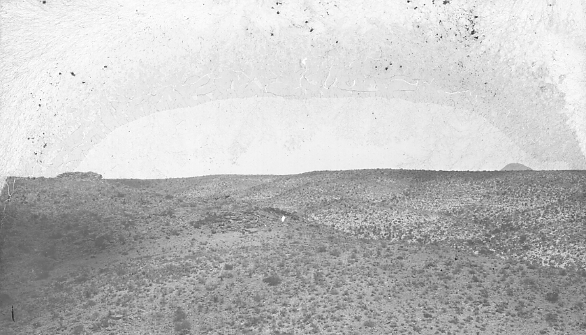
| 381.A.10 | Henderson laccolite. View to right of No. . Center and left limestones over core, right, the core brought up by a fault. In distance the Rosillos Mountains, an enormous dissected laccolite. 70 miles south Alpine, Brewster County, Texas. |
| 381.A.11 | Upper surface of Henderson laccolite. Limestones on right resting on igneous core shown in left half. No. is view to right of this. 70 miles south Alpine, Brewster County, Texas. |
IGNEOUS ROCKS. COMPOSITION |
|
| 383.-.1 | Diagram to illustrate chemical variation of igneous rocks. |
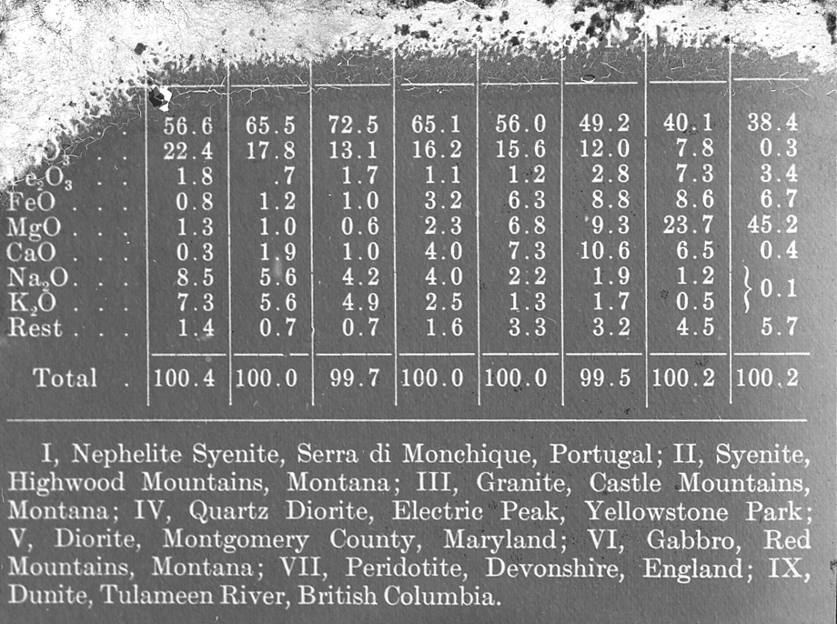
| 383.-.2 | Diagram showing chemical analyses of typical igneous rocks. |
| 383.-.3 | Diagram to illustrate the varying proportions of the minerals of typical igneous rocks. |