This is a list of slides with their descriptions. The comments (if there are any) about the slides are on the page with the slide. Right now the slides are listed in numerical order, but that may change soon. If you have any favorite slides, have a current picture of someting, or have any comments on slides, send an email to huwig@cwru.edu.
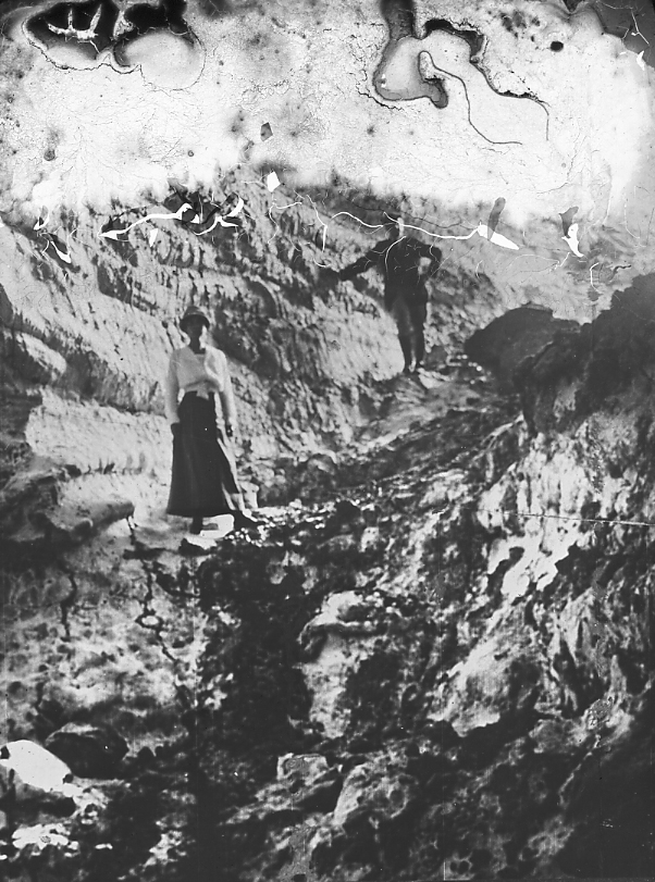
| 21. .3 | House excavated in Loess, Shiwantsee, China. |
| 27. .4 | Debris dropped at mouth of a culvert by spreading current. View down-stream from culvert. Shows “shooting power” of culvert. Debris since removed by less powerful floods with smaller loads, block at a time. Storms of June 30 and July 9, 1917. Euclid Boulevard and Murray Hill Road, Cleveland, Ohio. |
| 31.B.4 | Miami Conservancy District. Taylorsville Dam. View upstream from crest of dam showing Miami River, the lower end of ponding basin, and on right, till filling of valley excavated to build dam. |
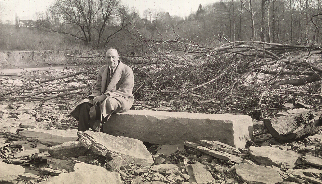
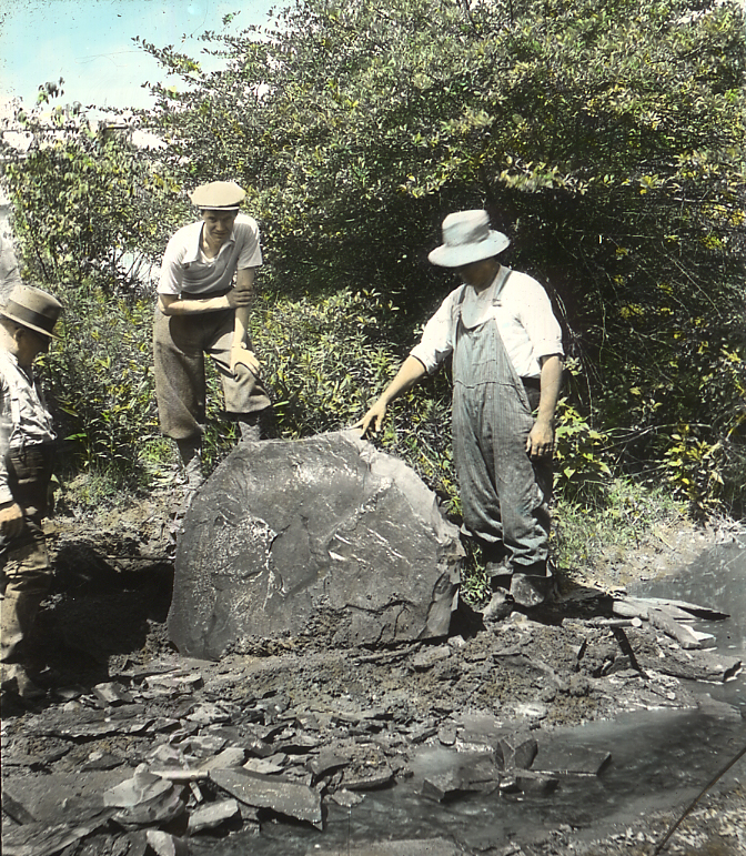
| 48.C.7 | Rocky River bar formed by flood water at head of backwater of lake. Sandstone block 5’10” by 1’8″ by 1’2″. Rocky River above Detroit Street bridge. May, 1928. |
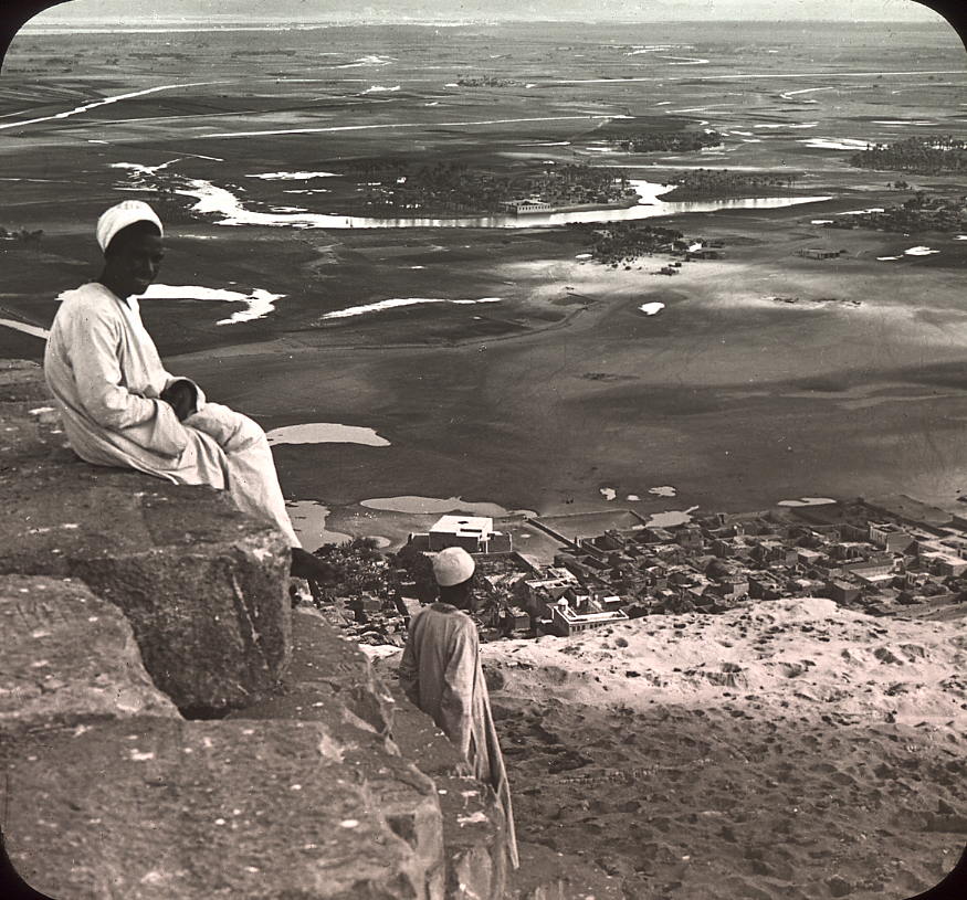
| 49.B.2 | Nile Valley at head of Delta, 120 miles inland, from summit of Great Pyramid, east southeast, delta to left, Sahara behind you to right. River in distant left and just below valley wall. Traces of old channels in foreground, which are filled by inundations. |
| 117. .3 | Entrance to a sink hole, Padirac, France. |
| 119.B.13 | Mammoth Cave, Kentucky. Old Entrance. Echo River. |
| 119.B.35 | Great Onyx Cave, near Mammoth Cave, Ky. First artificial entrance, said to have been discovered by the upright blocks between the boys. |
| 137.C.14 | Crevasse, Logan Glacier, Alaska. |
| 137.E.6 | Glacier National Park. Grinnel Glacier. Terminal moraine nod abandoned a few rods below present edge. Stream from glacier. |
| 137.E.12 | Glacier National Park. Grinnel Glacier. Ascending the 300′ rock wall behind the lower glacier. |
| 137.E.14 | Glacier National Park. Grinnel Glacier. Upper Glacier. Beginning the ascent. |
| 167.A.1 | Glacial erratics |
| 169.D.2 | Morainic topography. Lake Punderson, 3 miles S.W. Burton, Ohio. |
| 263. .12 | Wave destruction on clay cliffs during high stage of Lake Erie, winter of 1928-29. Camera standing in middle of former road. Man also. Waves breaking obliquely. Mentor Headlands, Painesville, O. |
| 295. .1 | Sea urchin burrows in trachyte. Pernambuco, Brazil. |
| 297. .7 | Cane Brake, Dismal Swamp. |
| 297. .9 | General aspect of wide swampy channels that connect main swamp with tributary swamps to west. Dismal Swamp. |
| 299. .3 | Mangrove trees, Jupiter Narrows, Florida. |
| 339. .1 | Mud cracks, Sagamore Creek, Cuyahoga River near Bedford, O.; mud formed by flood of June 28, 1924. Photo Sept. 1924 |
| 339. .3 | Sun cracks in mud pumped from Hudson River for newly made land. Cracks formed summer of 1910, photo taken May 1911, after a winter’s exposure. New York City. |
| 355. .1 | Concretions in Ohio shale, near Columbus. |
| 361.B.15 | River of lava flowing 15 miles per hour. Halemaumau, Kilauea, Island of Hawaii. |
| 361.B.16 | Tunnel in lava through which the river of lava (361.B.15) flowed a few weeks before. Halemaumau, Island of Hawaii. |
| 361.F.5 | Katmai. The ash-loaded Katmai in 1915. |
| 361.F.24 | Katmai. Valley of 10,000 Smokes. A vent pouring out steam which is transparent because uncondensed. |
| 361.F.25 | Katmai. Valley of 10,000 Smokes. Griggs frying bacon over a fumarole, steam invisible and supporting the pan and stick. |
| 401. .3 | Pre-cambrian gneiss cutting Precambrian granite. Man is on granite; contact cuts gneiss squarely beneath foreground patch of soil. Kingston, Ontario. All hill and valley here shown are Pre-ordovician, disclosed by removal of earlier Paleozoic limestone. Slide 481.B.3 and 4 are at water level below dead tree. |
| 481. .3 | Unconformable contact, gneiss and Trenton, 1/2 mile from Montmorency Falls, New York. |
| 501.C.7 | A remnant summit of the Callahan Divide. Signal Butte, Howard County, Texas. Physiog. Atlas, 3. |
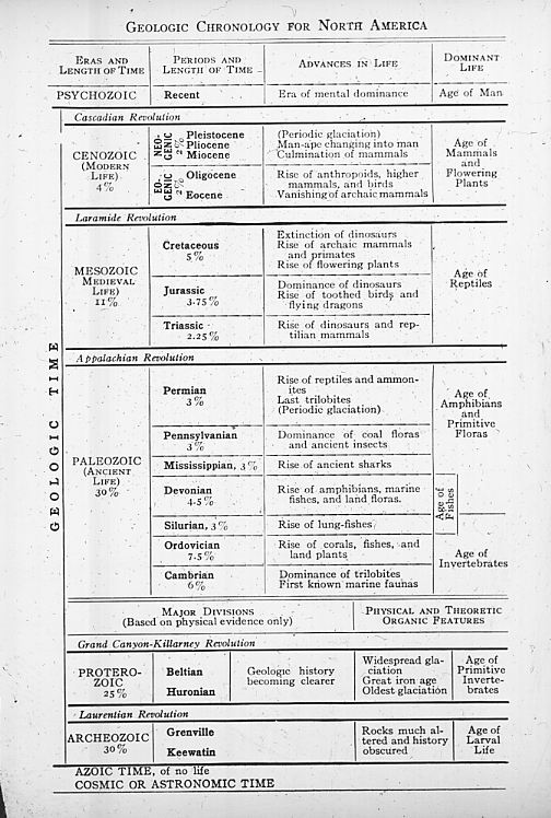
| 651. .1 | Geological Column after Schuchert. |
| 657.C.13 | Belt Series. Scarface Point, Garden Wall Trail on west side of Continental Divide. Glacier National Park, Mont. |
| 675. .35 | Dinichthys terrelli. No. 768, C.M.N.H., with largest jaw yet found, no. 5936, C.M.N.H. |
| 676.B.10 | Removing Eospermatopteris stump from Riverside Quarry, Gilboa, N.Y. |
| 716.C.3 | Diceratherium Quarry, Cook Ranch, Agate Springs, Nebraska. Carnegie and American Museum quarry in Carnegie Hill. Harrison Formation, Lower Miocene. Captain Cook is working on an exposed portion of the bone bed. |
| 716.C.5 | Dicerathium slab. Agate Springs Quarry, Cook Ranch, Sioux Co., Nebraska. Harrison Formation, Lower Miocene. |
| 736.C.4 | Specimen Ridge, overlooking Lamar River, Yellowstone National Park. Petrified stump of Sequoia magnifica, an extinct species. |
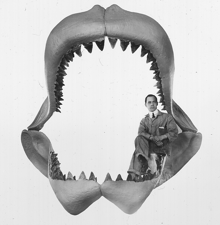
| 738. .4 | Restoration of fossil shark. Carcharodon megalodon. Basal Miocene South Carolina. 60 ft. in length. |
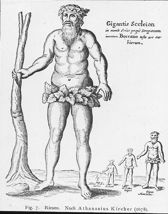
| 748. .15 | Giants (“Reisen”) of Athanasius Kircher. A first attempt to reconstruct the ancient animals, largely mammoth, which left large bones in the rocks of the earth. |
| 748.B.12 | Fossil Tree (Cupressus macnabianus), from Pit 3. |
| 748.D.5 | Restoration of Mastodon Americanus, Chas. R. Knight, American Museum of Natural History. Detail of Mural Hall of Man. |
| 748.E.2 | Cleveland Mammoth, Now in Dept. of Biology, W.R.U. Side view of jaw. |
| 754.C.6 | Wind Erosion on hard Eocene limestone. Indicates agent probably largely responsible for erosion of the Faiyum Basin to below sea level. Faiyum Basin, Nile Valley, Egypt. |
| 756.L.3 | Late Neolithic dolmen, possibly a temple, near Saumur, France. 65 ft. long, 24 ft. wide, 15 ft. above ground. The vertical slabs are buried 9 ft. deep. |
| 756.M.4 | Neolithic Bronze Culture, Megalithic type, age uncertain, about 4000-5000 years ago. Carnac, Brittany, France. A Megalithic “allignment”. |
| 759.B.10 | Hopewell group, the type station of the Hopewell culture. |
| 759.B.14 | Mound Builders, Newark group, the wall of the circle. |
| 759.B.16 | Mound Builders and Indians. Flint Ridge, Block of Flint. |
| 769. .7 | Father Stephen Richarz S.D.V. of Techny, Ill. Roman catholic interpreter of geological history, especially in history of ancient man. Died, Jl. 15, 1934, age 60. Zenolith in granite intrusion near Mellen, Wisconsin. |
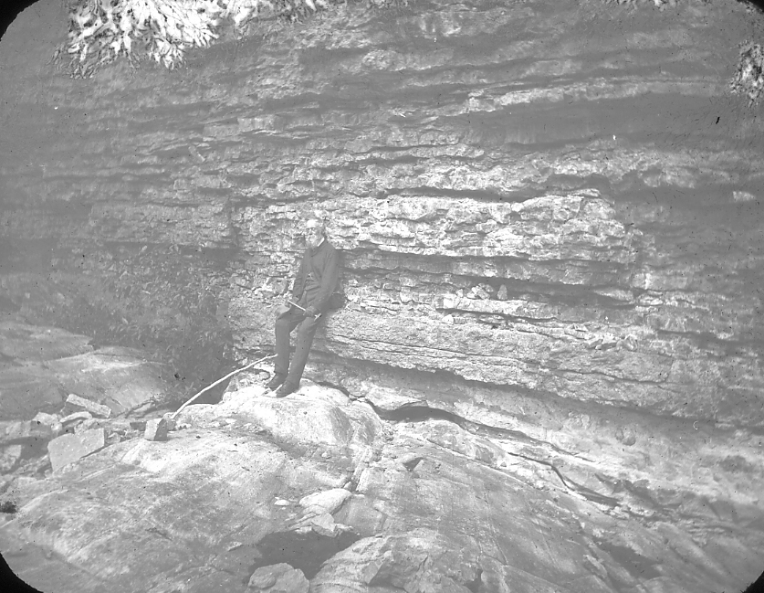
| 1006.Ba.3 | Columbus Limestone, Sandusky Ohio. At boys shoulders the Diphyphyllum zone with corals in stone as they grew erect. |
| 1006.Da.1 | Olentangy shale with overlying base of Ohio Shale. Olentangy River near Lewis Center, between Columbus and Delaware, Ohio. |
| 1006.Ga.5 | Cleveland shale. 5 Dinichthys bones in view between outside hands. Vermilion River, mouth of Chance Creek. |
| 1006.Ga.7 | Cleveland shale. Bungart removing a huge but very poor Ctenacanth shark. The shark occupied the excavation, and extended and was excavated to Mr. Williams’ hand, at the left. Vermilion River, Rugby, Ohio. Sept. 1924. |
| 1006.Ga.9 | Cleveland shale, Big Creek, S.W. of Cleveland. Bungart excavating concretion which contained only an obscure bone fragment. Almost the entire Cleveland is shown. |
| 1006.Ga.14 | Bungart removing Titanichthys bone from Cleveland Shale, Big Creek, Cleveland. |
| 1006.Ga.15 | Steam shovel excavating for fossil fishes, Big Creek, Cleveland May 1926. 1. A concretion hooked. |
| 1006.Ga.22 | Cleveland formation, showing joint pattern. Bedford obscure above it. Tributary to Tinker’s Creek from South (Silver Ck.), Bedford, Ohio. |
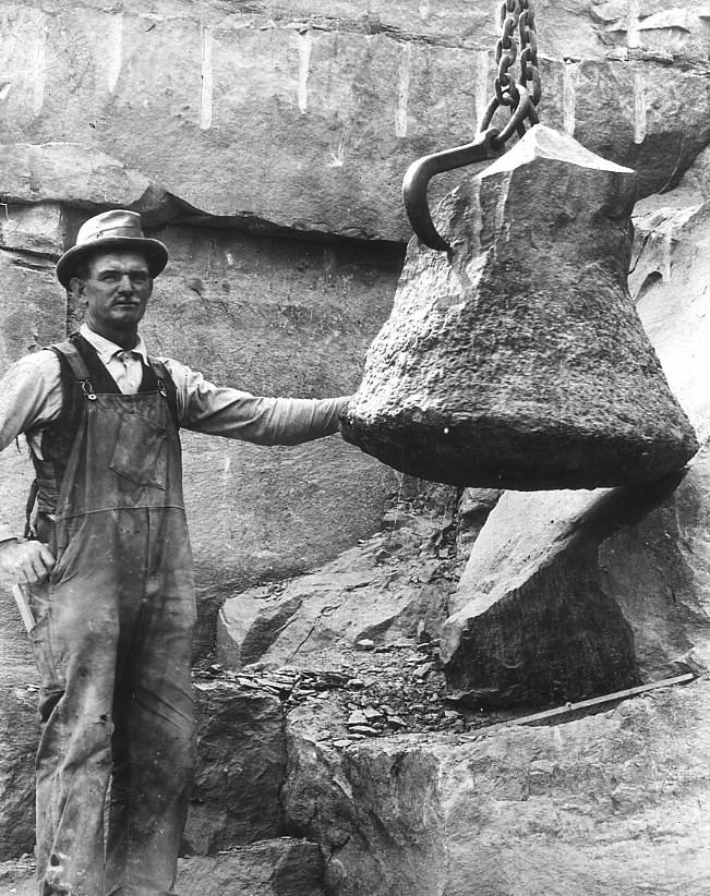
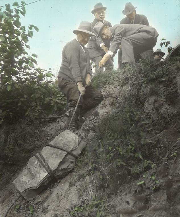
| 1006.Ga.23 | Concretion being hauled up bank from excavation. C.M.N.H. No. 5678. See slide 1006.Ga.24 for content. Cleveland shale, Big Creek, S.W. of Cleveland, O. P.A. Bungart, collector, left front. P.M. Rea 1st director C.M.N.H. Aug. 1927. |
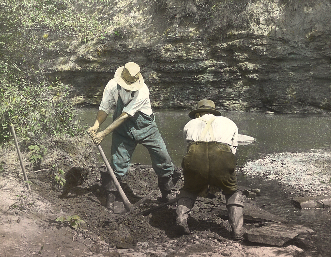
| 1006.Ga.25 | Raising concretion from shales in stream bed. Contained shark Cladoslache. See slide No. 1006.Ga.26. C.M.N.H. Specimen No. Cleveland Shale Big Creek, above Rhodone Road bridge, S.W. of Cleveland, O. |
| 1006.Ga.27 | Half a concretion, which contained Dinichthys jaw. (C.M.N.H. No. 5959) shown in slide No. 1006.Ga.28. Cleveland Shale, Big Creek, S.W. of Cleveland above Rhodone Road bridge. July 1930. Left to right, P.A. Bungart, collector, C.M.N.H.; Dr. A. Heintz, Oslo, Norway; F.G. Shepherd, coll., C.M.N.H. |
| 1006.Ga.30 | Cleveland Shale, Rocky River, first bank below Cedar Point. Discovery of Dinichthys, Specimen, 768 of C.M.N.H. |
| 1008.Ba.3 | Bedford formation, tributary to Tinker’s Creek, Bedford, Ohio. Sandstones with ripples trending N.W. – S.E. |
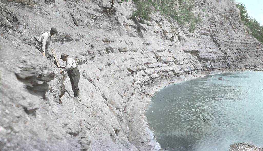
| 1008.Ch.2a | Berea Formation, showing large joint block. About 1925, a joint block from top fell out of right center. A spring from joint at base of Berea on left, carries about one ton per year of dissolved rock. Lowest 15′ bed is slightly cross-bedded and faulted before next bed was deposited. South wall Tinker’s Creek at Penn. R.R., Bedford, Ohio. |
| 1008.Ea.1 | Lower part of Orangeville Shale; Sandstone beds in creek with Ceratodictyia (sponge). Sharon on hill above view cuts to within about 125′ Berea. Aurora Br. 3 1/2 mi. SE Squaw Rock. |
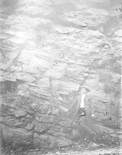
| 1008.Eb.2 | Black Hand conglomerate. Lancaster, Ohio. Northwardly dipping foreset beds of the delta or sandspit type. |
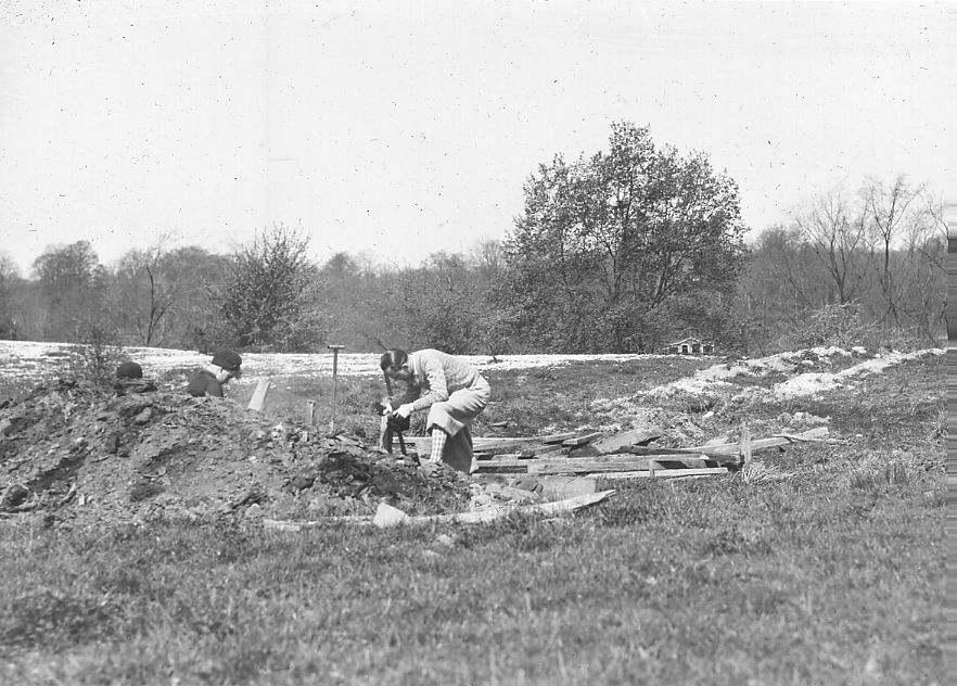
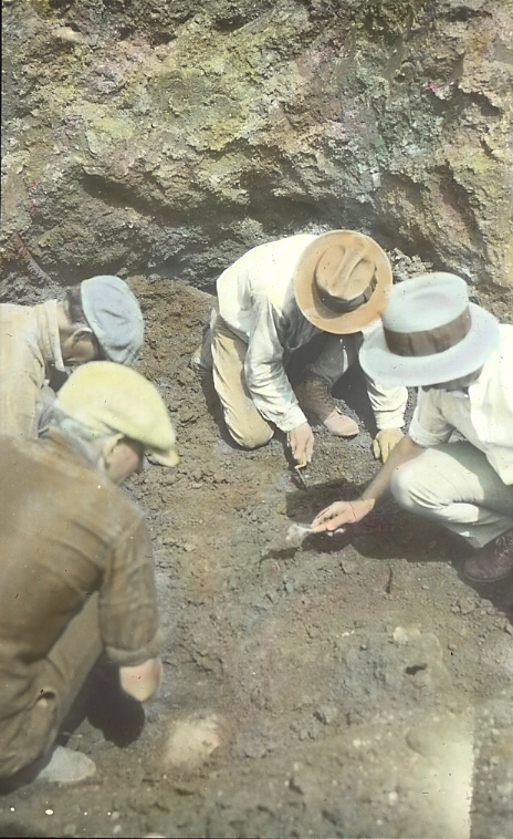
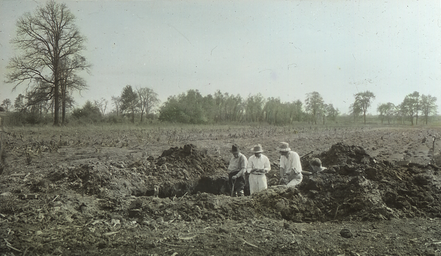
| 1018.B.2 | Excavation for small mastodon in bed of post-glacial lake filled with clay and peat. A few teeth and scattered small bone fragments were found, May 1930. Mud Brook, 2 miles S.W. of Hudson O. See slides 1018.B.1 and 1018.B.3. |
| 1022.C.5 | Whittlesey Beach, 130 feet above present lake, with rounded cobbles of Berea Grit from a nearby old cliff. Three miles south of Vermilion, Ohio. |
| 1022.C.6 | Shore Lake Erie, Edgewater Park, looking west. Shale cliffs in distance, Cuyahoga delta sand cliffs left, in middle the shale slopes under the sand, the west wall of the Pre-Maumee Cuyahoga Valley. |
| 1022.C.9 | Upper Arkona Cliff, Nickle Plate cut, west of Fairmount Road, Cleveland, 1929. Old peat bed with black spruce of this stage, buried under Whittlesey sand. |
| 1022.C.15 | Gravels of Lake Whittlesey shore line, with cross bedding toward east. Portion of bar built from west across Grand River Valley. Gravels are at Whittlesey level. 1 1/2 miles S.E. of Painesville, Ohio, just north of mouth of Kellogg Creek. May, 1930. |
| 1351.A.1 | Cleveland weather map, February 8, 1909 |
| #### | What one of the Quarries in Berea looks like today. Pictures courtesy of Nicole Scafidi. |