Devonian | Ohio Shale | Chagrin Shale | Cleveland Shale
Mississipian | General | Bedford Shale | Bedfor Formation, Cleveland, Ohio | Berea Grit | Berea Grit, Berea | Berea Grit, Belt Line Cut | Berea Grit, Amherst, Ohio | Berea Grit, Birmingham | Berea Grit, Lithopolis, Ohio | Sunbury Shale and Aurora Sandstone | Cuyahoga Formation- General | Cuyahoga Formation. Orangeville, Sharpsville and Royalton Formations of Northern Ohio | Cuyahoga and Black Hand, Fairfield Co. | Cuyahoga and Black Hand, Licking Co. | Logan Formation | Fairfield County | Licking County | Scioto County | Maxville Limestone
Pennsylvanian | General | Pottsville, Sharon; Scotland, Ohio | Pottsville, Sharon, Nelson’s Ledges, Ohio | Allegheny Formation
GENERAL |
|
| 1000.-.1 | Ohio. Geological map of Ohio. |
| 1000.-.2 | Ohio. Generalized topographic map of the upland surface. Disection disregarded. |
| 1000.-.3 | Ohio. Allegheny plateau and Interior Lowland. |
| 1000.-.4 | Ohio. Physiographic Provinces. The heavier line denotes the glacial boundary. |
| 1000.-.5 | Ohio. Soil Map. |
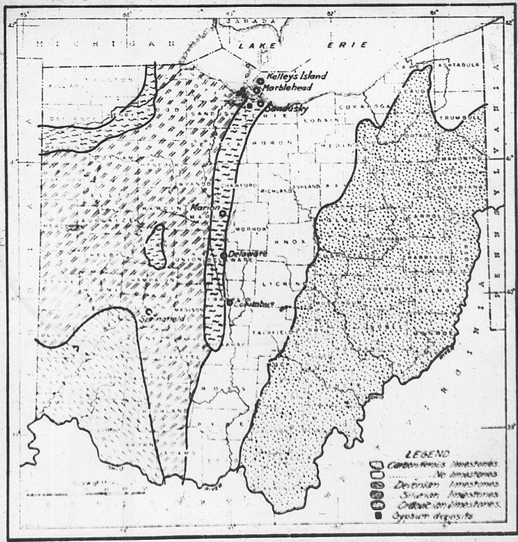
| 1000.-.6 | Ohio. Limestone and gypsum deposits. |
| 1000.-.7 | Ohio. Oil, gas and salt. |
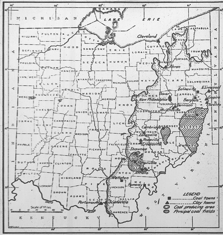
| 1000.-.8 | Ohio. Coal fields, coal towns and clay towns. |
GENERAL–CLEVELAND REGION |
|
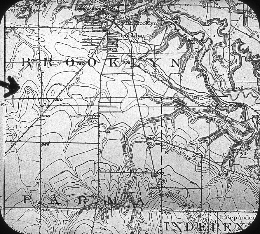
| 1000.B.1 | Cuyahoga County with streams. |
| 1000.B.2 | Geological cross-section across Cuyahoga County, S.W. to N.E. |
| 1000.B.3 | Cleveland Region, generalized Paleozoic section, outcrop and wells. Sharon to “Trenton”. |
DEVONIAN |
|
| 1006.Ba.1 | Columbus Limestone (Onondaga, Devonian) Chert zone in lower part; Eversole Run, southern part Delaware Co., O. 5 miles N. of Dublin. West of Scioto River. |
| 1006.Ba.2 | Columbus Limestone (Devonian). Hayden Falls, Franklin Co., Ohio. |
| 1006.Ba.3 | Columbus Limestone, Sandusky Ohio. At boys shoulders the Diphyphyllum zone with corals in stone as they grew erect. |
| 1006.Ba.4 | Columbus Limestone (Onondaga, Middle Devonian). Chert zone in lower part. Deer Run, 3 1/4 miles North of Dublin, Ohio, on S. edge of Delaware Co., West of Scioto River. |
| 1006.Ba.5 | Columbus Limestone, 10′ of Delaware Ls. at top. (Onondaga Limestone, Middle Devonian). taylor-Bell or Columbus Stone Co. quarry, Marble Cliff, W. of Scioto River, near Columbus, Ohio. |
| 1006.Ba.6 | Columbus Limestone (Onondaga, Middle Devonian). Hayden Falls, 2 1/2 mi. S. of Dublin. W. of Scioto River. |
| 1006.Ca.1 | Columbus Limestone overlain by Marcellus facies (Whitfield) of Delaware Limestone. Collecting bag covers the bone bed at top of Columbus. 3 miles N. of S. line of Dublin Quad. East of Scioto River. |
| 1006.Da.1 | Olentangy shale with overlying base of Ohio Shale. Olentangy River near Lewis Center, between Columbus and Delaware, Ohio. |
DEVONIAN. Ohio Shale. |
|
| 1006.Ea.1 | Ohio Shale. The “Narrows”. Columbus, Ohio. |
| 1006.Ea.2 | Concretions in lower part of Ohio Shale. Either Worthington or Flint or Lewis Center, east of Olentangy River, Ohio. |
| 1006.Ea.3 | Concretions from Lower part of Ohio Shale; one is double. Worthington, Ohio, West od Olentangy River. |
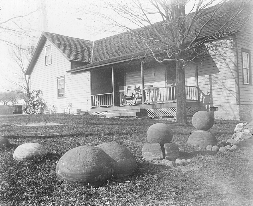
| 1006.Ea.4 | Huge concretion, known as “Huron River Boulder” fallen from the “Huron” shale. Huron River below Norwalk. |
DEVONIAN. Chagrin Shale. |
|
| 1006.Fa.1 | Chagrin Shale, Rocky River, Cleveland, Ohio. |
| 1006.Fa.2 | Chagrin Shale, Rocky River, Cleveland, Ohio. |
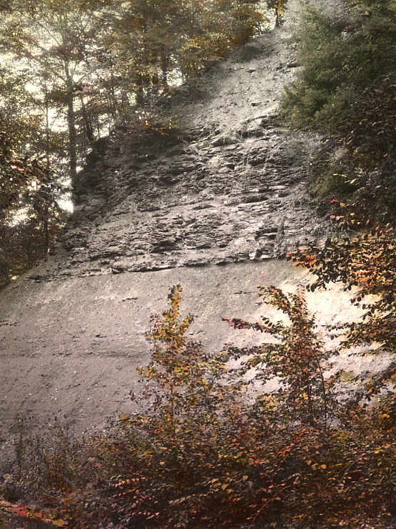
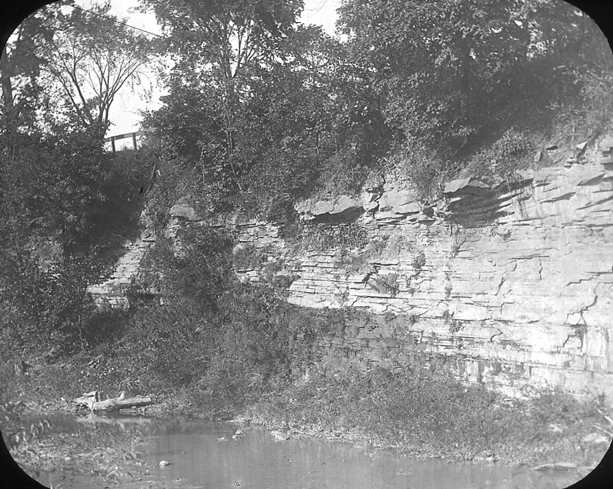
| 1006.Fa.3 | Chagrin shale bank, Euclid Creek. Base of Cleveland shale at top. Chagrin shale gullied by rain. |
| 1006.Fa.4 | Chagrin shale overlain by Cleveland Shale. E. wall, Rocky River. Riverside Drive, Clifton Place to Madison. May, 1928. |
DEVONIAN. Cleveland Shale. |
|
| 1006.Ga.1 | Cleveland shaqle, Big Creek, S.W. of Cleveland; shows diastems in the Cleveland. |
| 1006.Ga.2 | Base of Cleveland shale, on Chagrin formation. Chippewa Creek, Brecksville, Ohio. |
| 1006.Ga.3 | Dinichthys terrelli, no. 768, C.M.N.H. was excavated in 1928, 1/4 from the right end, just left of dark spot, and half way up bank to it. See slides 675.-.34, 35 and 36. Cleveland shale, Rocky River, below Cedar Point. Feb. 1916. Slide 48.C.9 is essentially the same subject. |
| 1006.Ga.4 | Cleveland shale. Bungart excavating Titanichthys jaw. Vermilion River, Ohio. |
| 1006.Ga.5 | Cleveland shale. 5 Dinichthys bones in view between outside hands. Vermilion River, mouth of Chance Creek. |
| 1006.Ga.6 | Cleveland shale. Bungart removing huge Dinichthys head. Rugby, Vermilion River, Ohio. |
| 1006.Ga.7 | Cleveland shale. Bungart removing a huge but very poor Ctenacanth shark. The shark occupied the excavation, and extended and was excavated to Mr. Williams’ hand, at the left. Vermilion River, Rugby, Ohio. Sept. 1924. |
| 1006.Ga.8 | Cleveland shale. Concretion, which contained only a strap-shaped leaf 3 or 4 inches long. Big Creek. |
| 1006.Ga.9 | Cleveland shale, Big Creek, S.W. of Cleveland. Bungart excavating concretion which contained only an obscure bone fragment. Almost the entire Cleveland is shown. |
| 1006.Ga.10 | Conodonts of Cleveland Shale. Bedford, Ohio. |
| 1006.Ga.11 | Conodonts of Cleveland Shale. Bedford, Ohio. |
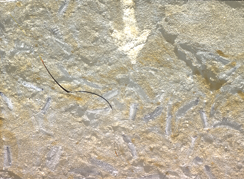
| 1006.Ga.12 | An enlarged spore case, Sporangites Huronensis. Scale given by arrow scratched with needle point. Cleveland shale. |
| 1006.Ga.13 | Spore cases of Sporangites huronensis. Clevaland shale Cleveland, Ohio. Surface about 3/4 inch long. |
| 1006.Ga.14 | Bungart removing Titanichthys bone from Cleveland Shale, Big Creek, Cleveland. |
| 1006.Ga.15 | Steam shovel excavating for fossil fishes, Big Creek, Cleveland May 1926. 1. A concretion hooked. |
| 1006.Ga.16 | Steam shovel excavating for fossil fishes, Big Creek, Cleveland, May 1926. 2. Concretion out. |
| 1006.Ga.17 | Steam shovel excavating for fossil fishes, Big Creek, Cleveland, May 1926. 3. Bungart opening concretion. |
| 1006.Ga.18 | Steam shovel excavating for fossil fishes, Big Creek, Cleveland, May 1926. 4. A good catch, Cladoselache. |
| 1006.Ga.19 | Concretion in Cleveland shale, containing a 5 foot cladoselachian. Big Creek. |
| 1006.Ga.20 | Cleveland shale resting on Chagrin shale. Rocky River, Cleveland, O. |
| 1006.Ga.21 | Cleveland formation over Chagrin. Tributary to Tinker’s Creek from South (Silver Creek), Bedford Ohio. |
| 1006.Ga.22 | Cleveland formation, showing joint pattern. Bedford obscure above it. Tributary to Tinker’s Creek from South (Silver Ck.), Bedford, Ohio. |
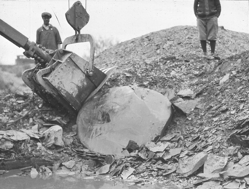
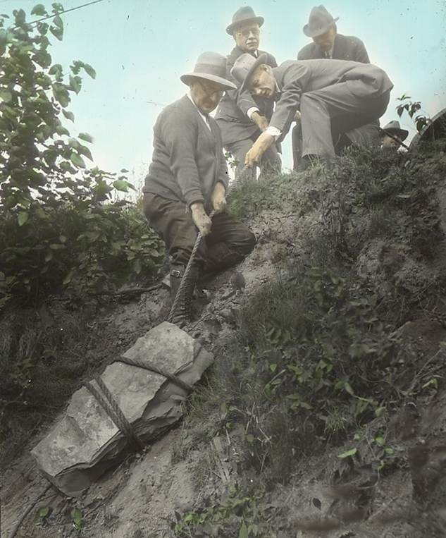
| 1006.Ga.23 | Concretion being hauled up bank from excavation. C.M.N.H. No. 5678. See slide 1006.Ga.24 for content. Cleveland shale, Big Creek, S.W. of Cleveland, O. P.A. Bungart, collector, left front. P.M. Rea 1st director C.M.N.H. Aug. 1927. |
| 1006.Ga.24 | Cladoselache, head and fore fins. C.M.N.H. No. 5678. As broken open in field. See slide 1006.Ga.23 for excavation. Clevland shale, Big Creek, S.W. of Cleveland O. |
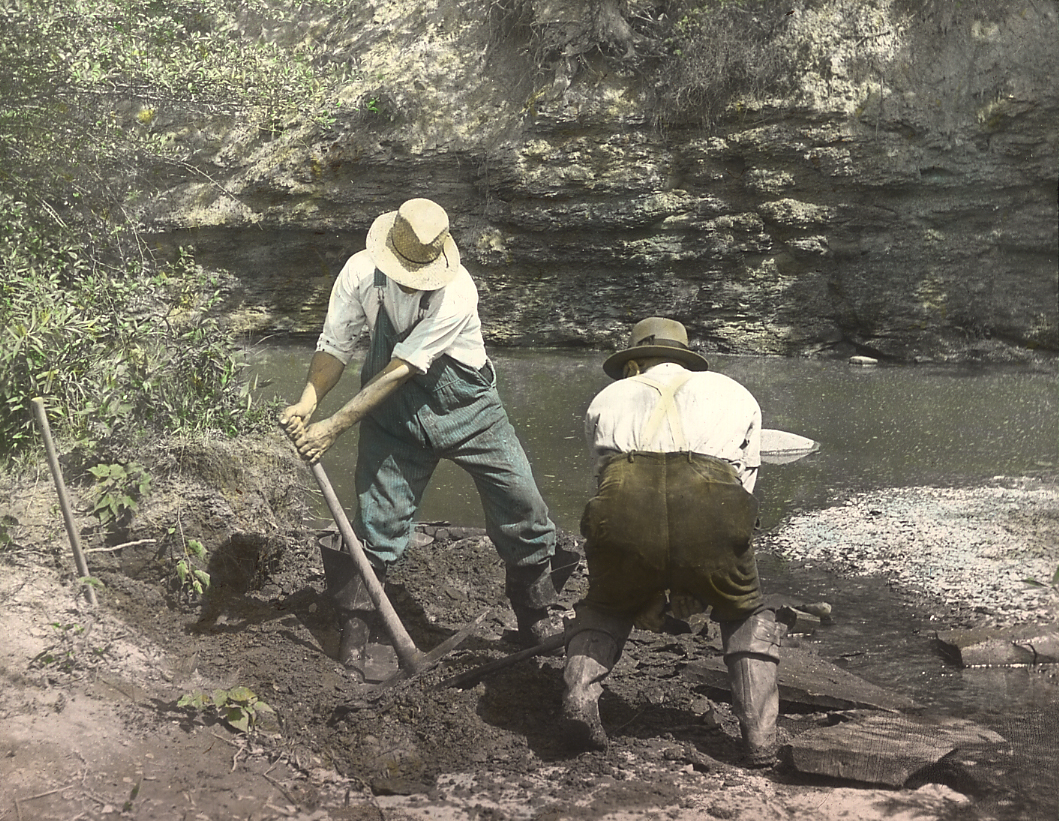
| 1006.Ga.25 | Raising concretion from shales in stream bed. Contained shark Cladoslache. See slide No. 1006.Ga.26. C.M.N.H. Specimen No. Cleveland Shale Big Creek, above Rhodone Road bridge, S.W. of Cleveland, O. |
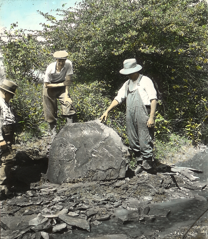
| 1006.Ga.26 | Shark Cladoselache, in concretion. C.M.N.H. specimen No. See slide No. 1006.Ga.25 for excavation. Cleveland shale, Big Creek, S.W. of Cleveland, O. |
| 1006.Ga.27 | Half a concretion, which contained Dinichthys jaw. (C.M.N.H. No. 5959) shown in slide No. 1006.Ga.28. Cleveland Shale, Big Creek, S.W. of Cleveland above Rhodone Road bridge. July 1930. Left to right, P.A. Bungart, collector, C.M.N.H.; Dr. A. Heintz, Oslo, Norway; F.G. Shepherd, coll., C.M.N.H. |
| 1006.Ga.28 | Left mandible, Dinichthys, with fossil plant obliquely acrss it. As broken open in field, See slide No. 1006.Ga.27. Specimen, C.M.N.H. No. 5959. |
| 1006.Ga.29 | Cleveland Shale, Rocky River, first bank below Cedar Point. Discovery of Dinichthys, Specimen, 768 of C.M.N.H. |
| 1006.Ga.30 | Cleveland Shale, Rocky River, first bank below Cedar Point. Discovery of Dinichthys, Specimen, 768 of C.M.N.H. |
MISSISSIPPIAN. GENERAL. |
|
| 1008.A.1 | Cuyahoga and Logan formations, E. to W. across Ross County, near Chillicothe, Ohio. |
| 1008.A.2 | General character of Cuyahoga and Logan Formations across Ohio, N. to S. and of the unconformit between the Moxvilla (limstone symbol) and the Pottsville. |
MISSISSIPPIAN. Bedford Shale. |
|
| 1008.Ba.1 | Bedford shale, Tinker’s Creek, Bedford, Ohio. Type locality. Berea sandstone at top, with fallen block at left. |
| 1008.Ba.2 | Bedford formation, Chippewa Creek, Brecksville, Ohio. Thin grey sandstone and shales of lower portion. Sandstone with ripples trending N.W.-S.E. |
| 1008.Ba.3 | Bedford formation, tributary to Tinker’s Creek, Bedford, Ohio. Sandstones with ripples trending N.W. – S.E. |
| 1008.Ba.4 | Bedford formation resting on Cleveland. Tributary to Tinkers Creek from south (Silver Creek) Bedford, Ohio. |
MISSISSIPPIAN. Bedford Formation, Cleveland, Ohio. |
|
| 1008.Bb.1 | Quarry in Bedford shale at Bluestone. Red shale above, blue shale midway, and bluestone at base. |
| 1008.Bb.2 | Euclid bluestone member, Bedford formation, Euclid Creek, Cleveland. May, 1916. |
| 1008.Bb.3 | Euclid bluestone member, Beford formatin, Euclid Creek, Cleveland. Ripples on surface of sandstone beds. Ripples trend N.W.-S.E., as do all ripples in Bedford formation from Lake Erie to Ohio River. |
| 1008.Bb.4 | Bedford Formation. The Bluestone member. Top of Cleveland at man’s left hand. Artificial cut for West Branch of Euclid Creek. Old Bluestone quarries. Photo Oct. 1935. |
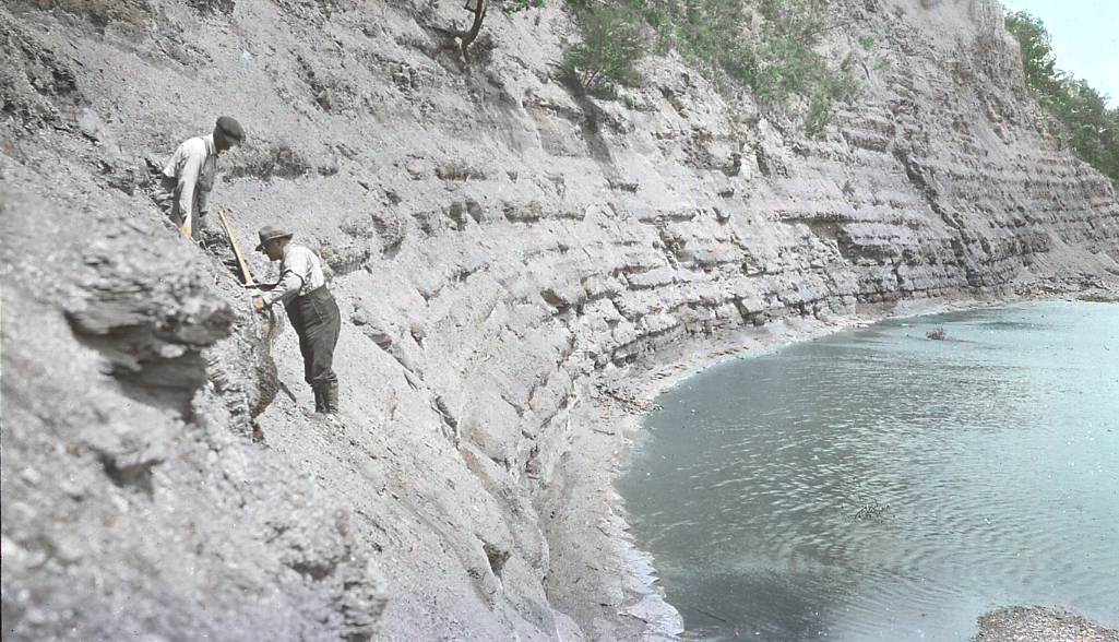
| 1008.Bc.1 | Cleveland shale, 10′-15′, at river; soft gray Bedford somewaht contorted, its base interrupted by physical disturbance after deposition. View southward on east wall of Black River, 2 miles, N.N.E. of Elyria. |
| 1008.Bc.2 | Contact, Bedford on Cleveland. Taylor’s Creek at road crossing 3 1/4 mi. N.N.E. of Elyria. |
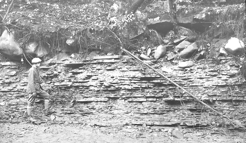
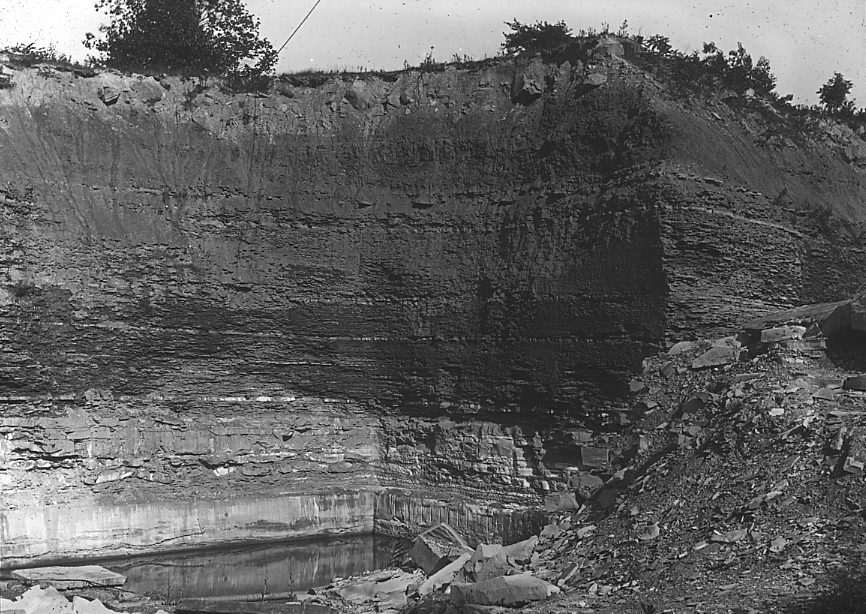
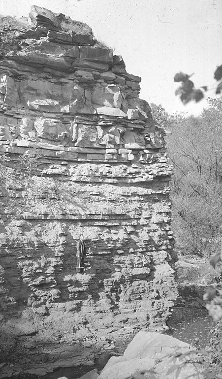
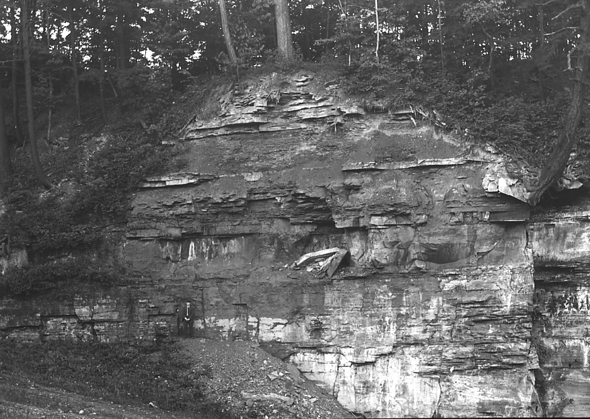
MISSISSIPPIAN. Berea Grit. |
|
| 1008.Ca.1 | Berea sandstone, Sunbury shale and Aurora flagstone, Tinker’s Creek, Bedford, Ohio. |
| 1008.Ca.2 | Berea Grit, full thickness. Rocky Fork, Gahanna, Ohio. |
| 1008.Ca.3 | Cross bedding in Berea Grit toward the northeast. Chippewa Creek. The thin horizontal layers carry ripples. Brecksville, Ohio. |
MISSISSIPPIAN. Berea Grit, Berea. |
|
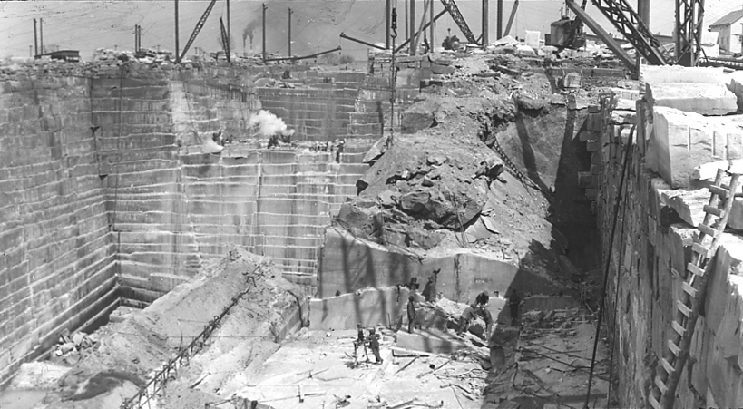
| 1008.Cb.1 | Berea Grit. Quarry No. 6, Cleveland Stone Co., Berea, O. Oct. 3, ’96. |
| 1008.Cb.2 | Berea Grit. Quarry No. 6, Cleveland Stone Co., Berea, O. Oct. 3, ’96. |
| 1008.Cb.3 | Cross bedding in Berea Grit, Rocky River, Berea, Ohio. |
MISSISSIPPIAN. Berea Grit, Belt Line Cut. |
|
| 1008.Cc.1 | Berea Grit, “Channel” filling in Bedford shale; Belt Line Cut, west of W. 73 St., Cleveland, O. |
| 1008.Cc.2 | Berea Grit, “Channel” filling in Bedford shale; Belt Line Cut, west of W. 73 St., Cleveland, O. Diagramatic cross section. |
| 1008.Cc.3 | Berea Grit, “Channel” filling in Bedford shale; Belt Line Cut, west of W. 73 St., Cleveland, O. East wall of filling resting against red Bedford. |
| 1008.Cc.4 | Berea Grit, “Channel” filling in Bedford shale; Belt Line Cut, west of W. 73 St., Cleveland, Ohio. West wall of channel resting on red Bedford. |
| 1008.Cc.5 | Berea Grit, “Channel” filling in Bedford shale; Belt Line Cut, west of W. 73 St., Cleveland, Ohio. Same view as 1008.Cc.4, different position. |
MISSISSIPPIAN. Berea Grit, Amherst, Ohio. |
|
| 1008.Cd.1 | Berea Sandstone, S. Amherst, Canyon Quarry, Ohio Quarries Co. Viw W. along long axis of “channel”, sandstone reported 217 ft. deep. Shale immediately outside sandstone mass on both sides. April, 1924. |
| 1008.Cd.2 | Berea Sandstone, S. Amherst O., Canyon Quarry. South wall looking east. Shows Bedford shale wedged from right between two tongues of sandstone, same wedge as No. April 1924. |
| 1008.Cd.3 | Berea Sandstone, S. Amherst, Canyon Quarry. South wall looking west. Bedford shale wedged from left between two tongues of sandstone. No. 1008.Cd.4 is to left of this view. |
| 1008.Cd.4 | Berea Sandstone, S. Amherst O., Canyon Quarry. Bedford shale and thin tongue of Cleveland wedged from left between two tongues of sandstone. No. 1008.Cd.3 is to the right of this. |
| 1008.Cd.5 | Berea Sandstone, S. Amherst O., Canyon Quarry, Ohio Quarries Co. View of top of sandstone, beneath shale wedge, shown in No. 1008.Cd.2, against slope and toward quarry. Shows bedding plane in sandstone beneath hammer with edges of bed moulded in plastic shale. April 1924. |
| 1008.Cd.6 | Berea Sandstone, S. Amherst, O., Quarry No. 6, Cleveland Stone Co., View west, showing practically the whole sandstone mass and its lens shape. Shale is encountered immediately outside the walls here shown to full quarry depth. May 1916. |
| 1008.Cd.7 | Berea Sandstone, S. Amherst, No. 6 Quarry, Cleveland Stone Co. North wall near top, bulged into quarry and exposing side of sandstone mass resting against shale. Contact about 451?4. |
| 1008.Cd.8 | Berea Sandstone, S. Amherst, No. 6 Quarry, the Cleveland Stone Co., Thin edge of wedge of Bedford shale projected into the sandstone about halfway down the wall. |
| 1008.Cd.9 | Berea Sandstone, S. Amherst, Ohio. Malone Quarry. View east, showing lens-shape of sandstone mass. |
| 1008.Cd.10 | Section of road fill across tidal marsh of Delaware Bay, showing amount of settling of fill before stability was reached, and displacement of marsh material, sideways and upwards. Strongly suggestive of method by which the Amherst and other thick “channel” masses of Berea Grit have been formed. |
| 1008.Cd.11 | Berea sandstone, S. Amherst, Canyon Quarry. View west along long axis of “channel,” Sandstone reported 217 ft. deep. Shale immediately outside sandstone mass on both sides. Apr. 1928 |
MISSISSIPPIAN. Berea Grit, Birmingham. |
|
| 1008.Ce.1 | North margin of Berea-Bedford filled “channel”, cut into Chagrin shale to left of center. Right of center, crest of anti-cline, which invariably occurs on either side of such “channels”. Result of contemporaneous local settling and sedimentation in Berea time. Mass shown in No 1008.Cd.2 is to the edge of trees at left. Vermilion River, below Birmingham, Ohio. |
| 1008.Ce.2 | Thick layer of Bedford sandstone standing nearly vertical in north margin of Berea-Bedford filled “channel”, folded twice. View of under side toward the channel wall showing slight fracturing of sand mass and much moist flowage. See 1008.Cd.1 for exact location. Vermilion River, Birmingham, Ohio. |
MISSISSIPPIAN. Berea Grit, Lithopolis, Ohio. |
|
| 1008.Cf.1 | Berea Grit, full thickness, Lithopolis, Ohio. |
| 1008.Cf.2 | Berea Grit, full thickness resting on Bedford formation by unconformity. Lithopolis, Ohio. |
| 1008.Cg.1 | Base of Berea unconformable on Bedford. Slide 1008.Cg.2 is 200 yards to the right. Aurora Branch of Chagrin River at Squaw Rock, near Chagrin Falls, Ohio. |
| 1008.Cg.2 | Base of Berea unconformable on Bedford. West side of a Berea-filled channel in Bedford. Slide 1008.Cg.1 is 200 yards to the left. Rocks on right fell about 1925. Aurora Branch of Chagrin River at Squaw Rock, near Chagrin Falls, Ohio. |
| 1008.Cg.3 | Ripple marks and worm trails in Berea Grit. Fallen blocks shown in slide 1008.Cg.2. Aurora Branch, Squaw Rock near Chagrin Falls, Ohio. |
| 1008.Cg.4 | Ripple marks, Berea Grit. Ravine on Ginn estate, west wall Chagrin River at Gates Mill. |
| 1008.Cg.5 | Topmost shaly, pyritic, marine member of Berea Grit. Aurora Branch, Squaw Rock, near Chagrin Falls, Ohio. |
| 1008.Ch.2a | Berea Formation, showing large joint block. About 1925, a joint block from top fell out of right center. A spring from joint at base of Berea on left, carries about one ton per year of dissolved rock. Lowest 15′ bed is slightly cross-bedded and faulted before next bed was deposited. South wall Tinker’s Creek at Penn. R.R., Bedford, Ohio. |
| 1008.Ch.2b | Berea Formation, showing large joint block. About 1925 a joint block from top fell out of right center. Spring from joint, base of Berea, carries about one ton per year of dissolved rock. Lowest 15′ bed is slightly cross-bedded and faulted before next bed was deposited. South wall of Tinker’s Creek at Penna. RR., Bedford, Ohio. |
| 1008.Ci.1 | Ripples in Berea Grit. French Creek at Avon, 7 miles East of Elyria on North Ridge Road. |
MISSISSIPPIAN. Sunbury Shale and Aurora Sandstone. |
|
| 1008.Da.1 | Sunbury shale, Lithopolis, Ohio. |
| 1008.Da.2 | Sunbury shale and Aurora sandstone (type locality) above Berea Grit. Aurora Branch, Squaw Rock, near Chagrin Falls, Ohio. |
CUYAHOGA FORMATION – GENERAL |
|
| 1008.E.1 | Central Ohio localites for Cuyahoga and Logan Formations. |
CUYAHOGA FORMATION. Orangeville, Sharpsville and Royalton Formations of Northern Ohio. |
|
RANDOM SLIDES |
|
| 1008.Ea.1 | Lower part of Orangeville Shale; Sandstone beds in creek with Ceratodictyia (sponge). Sharon on hill above view cuts to within about 125′ Berea. Aurora Br. 3 1/2 mi. SE Squaw Rock. |
| 1008.Ea.2 | Quarrystones in lower part of Cuyahoga formation, Lithopolis member, Lithopolis, Ohio. |
| 1008.Ea.3 | Base of Orangeville shale, resting on top of Berea Grit. Independence Brick Yard. South Newburg Tp. Cleveland. |
| 1008.Ea.4 | Orangeville Shale, Parma Tp. S.W. of Cleveland. |
| 1008.Ea.5 | Transition zone from Orangeville or Brecksville shale to Sharpsville sandstone. Brandywine Creek at Little York. Oct. 1921. |
CUYAHOGA AND BLACK HAND, FAIRFIELD CO. |
|
| 1008.Eb.1 | Black Hand conglomerate. Mt. Pleasant, Lancaster, Ohio. |
| 1008.Eb.2 | Black Hand conglomerate. Lancaster, Ohio. Northwardly dipping foreset beds of the delta or sandspit type. |
| 1008.Eb.3 | Top of the Black Hand conglomerate (massive) overlying the Berne conglomerate (type locality) and base of Byer formation. The Berne is composed of reworked gravels and sands of the top of the Black Hand under more normal marine conditions. |
| 1008.Eb.4 | Black hand sandstone (massive), Berne conglomerate and base of the Byer formation. Sugar Grove, Ohio. |
| 1008.Eb.5 | Top of Black Hand conglomerate (massive) overlying Berne conglomerate and base of Byer formation. State Farm, Lancaster, Ohio. |
| 1008.Eb.6 | Top of Black Hand conglomerate (massive) overlying Berne conglomerate and base of Byer formation. Allegheny Quarrie, Lancaster. O. |
CUYAHOGA AND BLACK HAND, LICKING CO. |
|
| 1008.Ec.1 | Top of Black Hand sandstone, Berne conglomerate at Hammer (Herrick’s conglomerate I) and base of the Byer formation. Stacel Cliff, Newark, Ohio. |
MISSISSIPPIAN. Logan Formation. |
|
| 1008.Fa.1 | Byer member, Logan formation (type section of Logan), Scott’s Creek, Logan Ohio. |
MISSISSIPPIAN. Logan Formation, Fairfield County. |
|
| 1008.Fb.1 | Allensville member (base at man’s feet middle of 10 ft. Allerisma zone, at hand, top midway up bank), and lower part of Vinton member of Logan. Rushville, Ohio. |
| 1008.Fb.2 | Top of Byer (man’s feet) and Allerisma zone of Allensville member to top of outcrop. Fossils in thin bed in attitude held in life. Rushville, Ohio. |
| 1008.Fb.3 | Top of Byer member (lower hand) to Allerisma zone of Allensville (lower hand to upper head). Foresman Dam, Rushville, O. |
| 1008.Fb.4 | Top of Byer member (lower hand) and Allerisma zone of Allensville (lower hand to upper head) Foresman Dam, Rushville, O. |
MISSISSIPPIAN. Logan Formation, Licking County. |
|
| 1008.Fc.1 | Top of Beyer member, (massive) Allensville and base of Vinton members of Logan. Newark, Ohio. |
| 1008.Fc.2 | Top of Beyer member, (massive) Allensville and base of Vinton members of Logan. Newark, Ohio. |
| 1008.Fc.3 | Top of Beyer member, (massive) Allensville and base of Vinton members of Logan. Newark, Ohio. |
MISSISSIPPIAN. Logan Formation, Scioto County. |
|
| 1008.Fd.1 | Top of Buena Vista sandstone, base of Portsmouth Shale. Lowest members of Logan Formation. Thomas quarry, about 1905 or 06. Carey Run, 3 mi. W. of Portsmouth, O. |
| 1008.Fd.2 | Buena Vista sandstone and Portsmouth shale, members of Logan formation. Portsmouth Shale Buena Vista Member. Reitz quarry, Carey Run. 3 miles W. of Portsmouth, O. |
| 1008.Fd.3 | Logan Formation, Beyer sandstone member with shales below of lower Beyer. The whole member passes into Portsmouth shale five miles to westward, into Beyer sandstone 3 miles to eqastward. About 1904 or 1905, Sciotoville, Ohio. |
MISSISSIPPIAN. Maxville Limestone. |
|
| 1008.Ga.1 | Maxville Limestone, Kent’s Run, White Cottage, Muskingum County, Ohio. |
PENNSYLVANIAN. GENERAL |
|
| 1010.A.1 | Ohio. Outcrop of the Pottsville and Allegheny formations, with fire clay pits or mines. |
PENNSYLVANIAN. Pottsville, Sharon; Scotland, Ohio. |
|
| 1010.Bb.1 | Sharon Conglomerate, Scotland, Mentor Sheet, Ohio. |
| 1010.Bb.2 | Edge of large gravel filled channel in sandstone. Scotland, Mentor, Sheet, Ohio. |
| 1010.Bb.3 | Small channel filling in sandstone. Sharon Conglomerate, Scotland, Mentor Sheet, Ohio. |
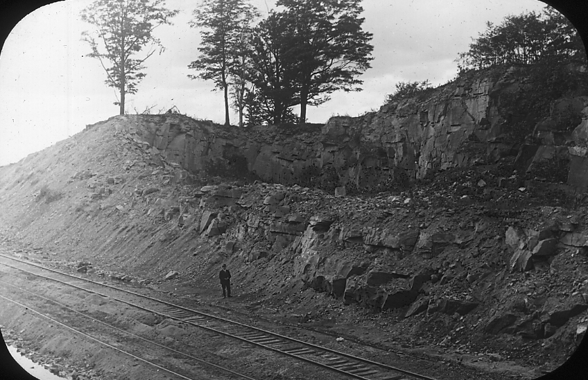
| 1010.Bb.4 | Pottsville (Sharon Conglomerate). Chesterland Caves, Ohio. |
| 1010.Bb.5 | Sharon Conglomerate. Widening of a joint plane by slipping of joint blocks down hill slope. Hinkley Ledges 15 miles south of Cleveland, Ohio. |
| 1010.Bb.6 | Sharon formation conglomerate and sandstone. Quartz pebbles, very rarely any other. Pre-Sharon erosion here places the base within 125′ of the Berea Grit. Aurora Branch, Bainbridge Tp. S. of road alt. 949′ at Rohrheimer place. |
PENNSYLVANIAN. Pottsville, Sharon, Nelson’s Ledges, Ohio. |
|
| 1010.Bc.1 | Sharon Conglomerate with repeated cross-bedding toward the southward, denoting southwardly moving currents and a northern source. |
| 1010.Bc.2 | Joints in Sharon Conglomerate, widened in part by slipping of blocks, in part by weathering. Nelson Ledges, Ohio. |
| 1010.Bc.3 | Joints in Sharon Conglomerate, widened in part by slipping of blocks, in part by weathering. Nelson Ledges, Ohio. |
| 1010.Bc.4 | Joints in Sharon Conglomerate, widened in part by slipping of blocks, in part by weathering. Nelson Ledges, Ohio. |
| 1010.Bc.5 | Basal conglomerate of Sharon, where it rests on the “Waverly”, (member not clear) with large residual pebbles of finegrained sandstone and ironstone, in part subsequently weathered out leaving moulds. Nelson Ledges, Ohio. |
PENNSYLVANIAN. Allegheny Formation. |
|
| 1010.Cb.1 | Lower Kittanning Coal, underlying L. Kittanning fire clay, and overlying ordinary shales with iron stone concretions. Strasburg, Tuscarawas County, Ohio. |
| 1010.Cb.2 | Lower Kittanning Coal, above entry, underlying L. Kittanning fireclay, and overlying ordinary shales with ironstone concretions. Strasburg, Tuscarawas Co., Ohio. |
| 1010.Cb.3 | Putmam Hill limestone and Brookville Coal ( the last at base of Allegheny formation. The Homewood and Clarion sandstone horizons are here replaced entirely by shale. |