General | Cleveland Region | Circleville, Ohio | Drainage Changes | Lake History, Northern Ohio | Physiographic Subdivisions | Physiographic Subdivisions, Ross County
OHIO GLACIATION. GENERAL. |
|
| 1018.-.1 | Ohio. Moraines and higest lake shore. |
| 1018.-.2 | Ohio. Moraines and stream systems, showing control of the latter. |
| 1018.-.3 | Ohio. The Lake plain. Ottawa Qd., Putnam County. |
| 1018.-.4 | Ohio. The unglaciated Plateau. Steubenville Qd., Jefferson Co. |
| 1018.-.5 | Ohio. The glaciated plateau. Garrettsville Qd., Portage Co. |
OHIO GLACIATION. CLEVELAND REGION. |
|
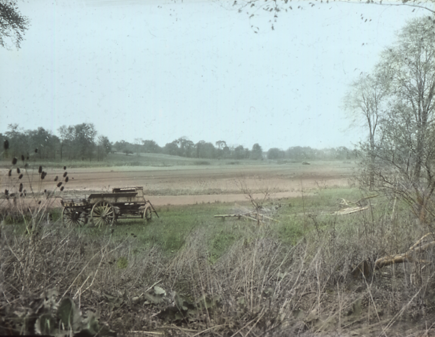
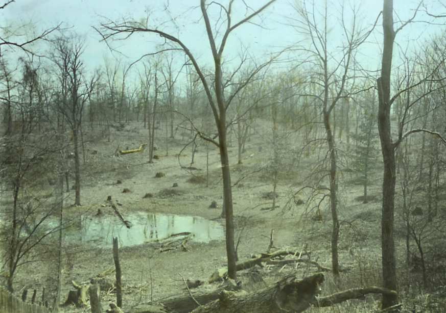
| 1018.B.1 | Mud Lake, remnant of a much larger post glacial lake, which had been partly filled in by clay and peat. Recently lowered by artificial drainage. Mud Brook, 2 miles S.W. of Hudson, O. See slides 1018.B.2 and 1018.B.3. |
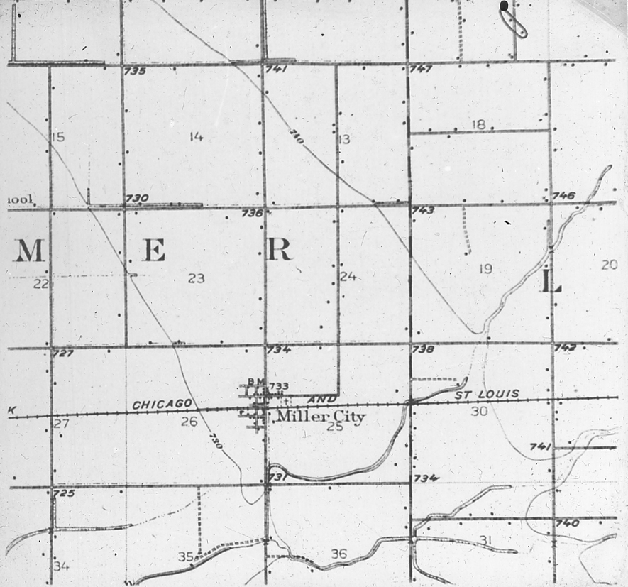
| 1018.B.2 | Excavation for small mastodon in bed of post-glacial lake filled with clay and peat. A few teeth and scattered small bone fragments were found, May 1930. Mud Brook, 2 miles S.W. of Hudson O. See slides 1018.B.1 and 1018.B.3. |
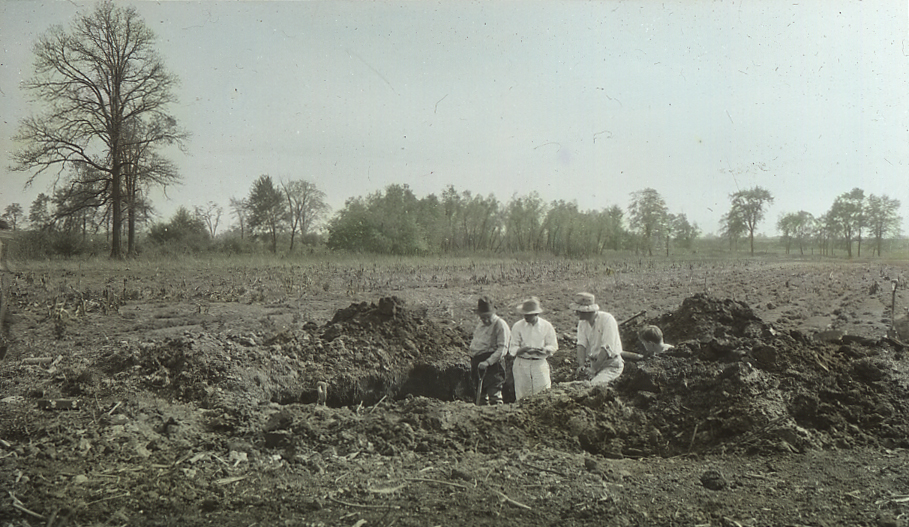
| 1018.B.3 | Post-glacial lake that had become a peat bog, now drained and farmed. Mud Brook, 2 miles S.W. of Hudson O. 1/2 mile south (downstream) of Mud Lake. See slides 1018.B.1 1018.B.2 |
| 1018.B.4 | Bird’s eye drawing (rough) of lower wnd of Cuyahoga Valley. Skinners Run, Big Creek and Mill Creek. |
| 1018.B.5 | Cuyahoga County relief with Defiance Moraine. Largely copied from Leverett, Bull. 818, U.S.G.S. |
| 1018.B.6 | Cuyahoga County relief with Euclid-Schaff Rd. moraine. Largely copied from Leverett, Bull. 818, U.S.G.S. |
| 1018.B.7 | Cuyahog County relief with known buried valleys of Rocky, Cuyahoga and Chagrin Rivers, Mill Creek and Tinkers Creek. |
| 1018.B.8 | Profiule sections across the Cuyahog Valley. |
| 1018.B.9 | Late Wisconsin gravel. Lytel pit, East 131st St. near Broadway. Shows method of working by floating sucker and pipe. |
| 1018.B.10 | Late Wisconsin gravel; overlain by pond-water clay (at level of left hand hopper) and by till (above the clay and below the sod). East 131st St. and Broadway, Cleveland, O. |
| 1018.B.11 | Late Wisconsin gravel overlain by thick pond-water clay and till. Liberty pit (abandoned) East 131 St. near Broadway, Cleveland, O. |
OHIO GLACIATION. Circleville, Ohio. |
|
| 1018.C.1 | Circleville esker, two miles north of South Bloomfield, Ohio. |
| 1018.C.2 | Circleville esker, Great Kettle, entirely surrounded by esker ridge, the result of a channel split around a block of ice. Circleville, Ohio. |
| 1018.C.3 | Circleville esker, Great Kettle, entirely surrounded by esker ridge, the result of a channel split around a block of ice. Circleville, Ohio. 1 1/2 mi. north of South Bloomfield, Ohio. |
| 1018.C.4 | Circleville esker, Gravel pit showing coarseness and assortment of water worn material. one mile south of South Bloomfield, Ohio. |
| 1018.C.5 | Circleville esker. Water laid gravel, highly rounded and poorly assorted, except that the sand sizes have been entirely removed. this indicates strong currents and rapid aggradation. one mile south of South Bloomfield, Ohio. |
| 1018.C.6 | Circleville esker. Surface of ridge showing extreme coarseness of gravels to top, absence of soil bed, and barrenness. |
OHIO GLACIATION. Drainage Changes. |
|
| 1021.-.1 | The pre-glacial outlet of the upper Muskingum system, now occupied by Licking River, reversed. View eastward up old valley, down present stream. Newark, Ohio. |
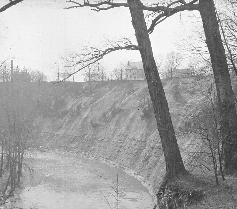
| 1021.-.2 | East wall of till filled preglacial Rocky River valley exposed by westward cutting of present Rocky River. S. E. of intersection of Wooster Rd. and |
OHIO GLACIATION. Lake History, Northern Ohio. |
|
(Also see under 746.B. Pleistocene, Great Lakes.) |
|
| 1022.C.1 | Cuyahoga valley, north from Schaff Rd. across surface of Whittlesey delta, at level of bridge which crosses post-Whittlesey trench. Slide 1022.C.2 is immediately to right. |
| 1022.C.2 | Cuyahoga Valley northeast from Schaff Rd. across surface of Whittlesey Cuyahoga trench, to rock wall of valley. Slide 1022.C.1 is immediately to left. |
| 1022.C.3 | Lake cliffs west from mouth of Rocky River. Buried pre-glacial valley of Rocky River is distant Dover Bay. |
| 1022.C.4 | Post-glacial trench of Rocky River at its mouth. |
| 1022.C.5 | Whittlesey Beach, 130 feet above present lake, with rounded cobbles of Berea Grit from a nearby old cliff. Three miles south of Vermilion, Ohio. |
| 1022.C.6 | Shore Lake Erie, Edgewater Park, looking west. Shale cliffs in distance, Cuyahoga delta sand cliffs left, in middle the shale slopes under the sand, the west wall of the Pre-Maumee Cuyahoga Valley. |
| 1022.C.7 | Site of discovery of Upper Arkona cliff, BNickle Plate RR., westward from Fairmount Road bridge, Cleveland, Ohio, 1929. Sections of cliff were exposed below pipe in foreground, and in cuts just beyond steam shovel (Slide 1022.C.8). Whittelsey sand in foreground. |
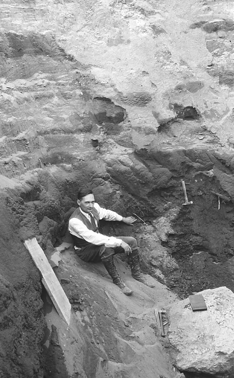
| 1022.C.8 | Cross section of Upper Arkona Cliff, Nickle Plate RR. cut, west of Fairmount Road, Cleveland, 1929. View East. On right; undisturbed Chagrin shale dipping right. Above right-hand boy’s hand; shale slumped off of old cliff under sub-aerial conditions. At left-hand boy’s hand; pond filling with black spruce flora and mastodon tusk. At top, Whittlesey sand. |
| 1022.C.9 | Upper Arkona Cliff, Nickle Plate cut, west of Fairmount Road, Cleveland, 1929. Old peat bed with black spruce of this stage, buried under Whittlesey sand. |
| 1022.C.10 | Upper Arkona Cliff, Nickle Plate cut, under north abutment of Fairmount Road bridge. Old peat bed with black spruce flora below 20 feet of Whittlesey sand. Cleveland, Ohio, 1929. |
| 1022.C.12 | Mentor Marsh. Outlet of Grand River at about the Nipissing stage and possibly later, subsequently filling to a depth of about 24 feet by rise in level of lake. A flora was obtained from a depth of about 20 feet in pier holes at bridge site in foreground. Feb. 1930. |
| 1022.C.13 | Mentor Marsh. Same station as 1022.C.12, but toward left. Old outlet of Grand River to the Lake. Feb. 1930. |
| 1022.C.14 | Gravels of Lake Whittlesey(?) shore-line, with cross-bedding toward southeast. Portion of bar built from west across Grand River valley. Gravels are below level of Whittlesey shore line, but apparently beneath gravels of Whittlesey age. 1 1/2 miles southeast of Painsville, Ohio, just north of mouth of Kellogg Creek, May 1930. |
| 1022.C.15 | Gravels of Lake Whittlesey shore line, with cross bedding toward east. Portion of bar built from west across Grand River Valley. Gravels are at Whittlesey level. 1 1/2 miles S.E. of Painesville, Ohio, just north of mouth of Kellogg Creek. May, 1930. |
| 1022.C.16 | Cuyahoga County relief with Maumee beaches. Largely copied from Leverett, Bull. 818, U.S.G.S. |
| 1022.C.17 | Cuyahoga County relief with Maumee and Whittlesey beaches, Largely copied from Leverett, Bull. 818, U.S.G.S. |
| 1022.C.18 | Cuyahoga County relief with Maumee, Whittlesey, Warren and Lundy beaches. Largely copied from Leverett. Bull. 818, U.S.G.S. |
OHIO. Physiographic Subdivisions. |
|
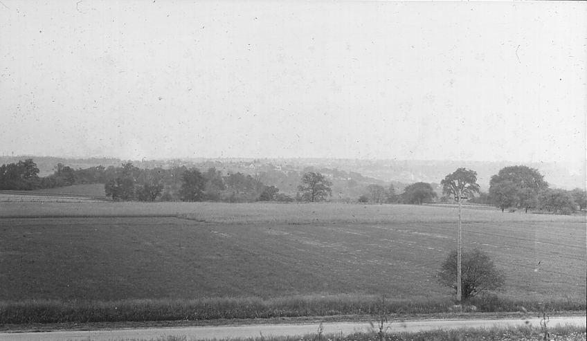
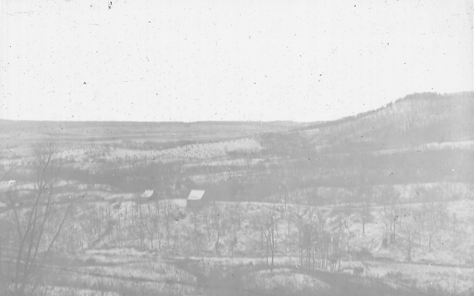
| 1025.B.1 | Northeast across Erie Plain (interior lowland) to margin of Allegheny Plateau. From Adelbert College, Cleveland, Ohio. |
OHIO. Physiographic Subdivisions, Ross County. |
|
| 1025.C.1 | Allegheny Plateau. Post-mature stage of dissection. View eastward from top of Sand Hill, Chillicothe, Ohio. |
| 1025.C.2 | Allegheny Plateau. Post-mature dissection, right and center. Interior lowland to left. View N.E. from top of Sand Hill, Chillicothe, Ohio. |
| 1025.C.3 | North-Northeast along margin of Allegheny Plateau into interior lowland. Chillicothe, Ohio. |